The scarp of Kondagala in Loolecondera Tea Estate is a beloved hiking destinations oof Sri Lankans, which until now attracts only few foreign guests. The reasons for the latter might be that Loolecondera is a little bit offside the standard round tour route and that Kondegala is rarely mentioned in guidebooks. Another reason could be that parts of the road are very bumpy. However, the area can be explored on a half-day excursion from Kandy or as an extra detour when driving from Kandy via Gampola to Nuwara Eliya. The scenic beauty of Loolecondera and Kondagala is worth it and the climb is uphill but short and easily manageable.
Location
Kondegala belongs to the Delthota Divisional secretariat located in the southern part of Kandy District. Driving distance on mountain roads from Kandy town via Hanthana and Galaha and Delthota to Loolecondera is 31 km (19 miles), plus 4 km (2.5 miles) more on a steep plantation dirt road, which is not easily passable for vans and normal cars. For those who do not want to walk a total of 8 km from the tea factory up and down, a jeep or tuctuc is more recommendable. Also the road between Delthota and Loolecondera is in a poor condition, but can be done by vans and normal cars when driving very slowly.
|
The road distance from Gampola via Galaha and Delthota to Loolecondera is 32 km (20 miles). When visiting Loolecondera Estate on the way from Kandy via Gampola to Nuwara Eliya, the detour takes 43 km (27 miles) more than the direct route, plus the said 8 km (5 miles) more on the plantation dirt road to the starting point of the short hike. There is a longer, but more comfortable alternative route from Kandy to Loolecondera, it runs further east along Victoria Reservoir and via Haragama and Ma Oya to Loolecondera. This route is 45 km (28 miles) long, 14 km more than the direct route from Kandy. Road distance from Nuwara Eliya to Loolecondera on the direct route via Mathurata and Rikilligaskada (NOT via Ramboda and Gampola) is 61 km (38 miles) from Nuwara Eliya. The road distance from Hewaheta village is 12km (7 miles).
|
Kondagala Rock is a ridge that forms a part of the crest of the main range of the central highlands of Sri Lanka. Roughly, this range stretches from Hanthana near Kandy to Pidurutalagala near Nuwara Eliya, with a trench or deep pass near Galaha. Kondagala is located almost halfway between the main peaks of Hanthana and Pidurutalagala, which are both in 16 km (10 miles) distance, as the crow flies.
Hiking to Kondagala
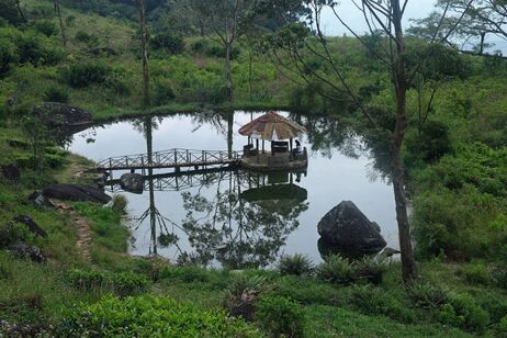
Compared to the high peaks of the range, the altitude of Kondagala is moderate, at 1500 m (almost 5000 feet) above sea level. The climb from the starting point of the trail to the top of the rock has to overcome a height difference of about 100 m (more than 300 feet). The height difference between the tea factory and the summit of Kondagala is 350 m (1150 feet). As said, you need to travel a further 4 km inside the Loolecondera plantation (also transcribed Loolkandura) uphill on a bumpy dirt road to reach the starting point of the hiking trail to Kondagala. An entry fee will be charged at the beginning of this small access road. Further uphill, it runs along a picturesque small tank, which has a summer hut in the middle, to which a wooden bridge gives access.
Near the starting point are further attractions, all of which are intimately connected to the biography of Scotsman James Taylor, who is the pioneering tea planter of Sri Lanka. He transformed Loolecondera, which had been a coffee plantation previously, into Sri Lanka's first tea plantation that procuced tea on a large scale and till the present day. James Taylor took his abode right at the foot of Kondagala rock, very close to the starting point of today's trail.
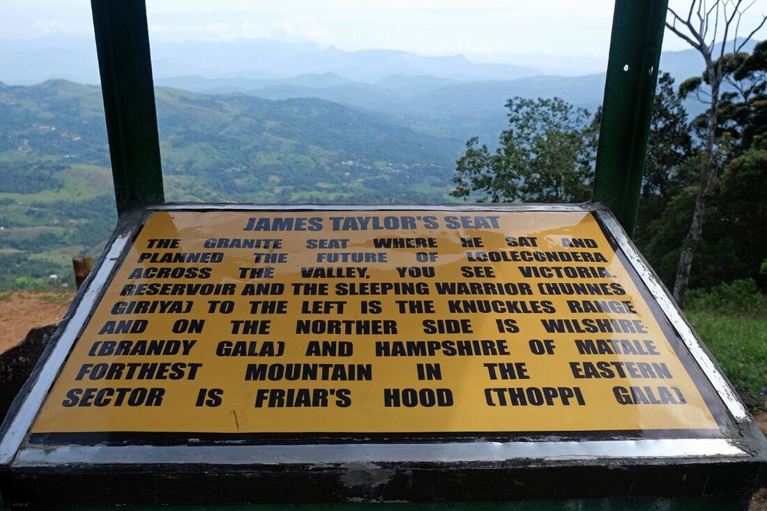
A nearby vantage point is known as Taylor's Seat. It can be reached via a gravel road of less than a kilometer. Taylor's Seat offers a 180-degree panoramic view to the Dumbara Valley formed by the Mahaweli Ganga, Sri Lanka's largest river, with Knuckles Range in the background.
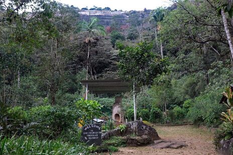
After starting the hike to the summit of Kondagala rock, you will cross a small area of ruins after only 200 m (650 feet). This group of former buldings, including a former bungalow, is the abovementioned place where James Taylor lived, when he developed then Ceylon's first tea estate, established in 1867. After having traveled to India to study the newly established tea growing techniques there in 1866, James Taylor lived here below Kondagala Rock for the rest of his life. A path branching off to the left leads to the freshwater spring of the compound, a small pond, and a little bit further to the so-called Field No. 7. Tea bushes Taylor planted here have not been harvested and therefore grown naturally ever since and this means, they are trees now, allowing you to walk literally in a tea forest. Botanically, the tea plant is a tree indeed and not a bush.
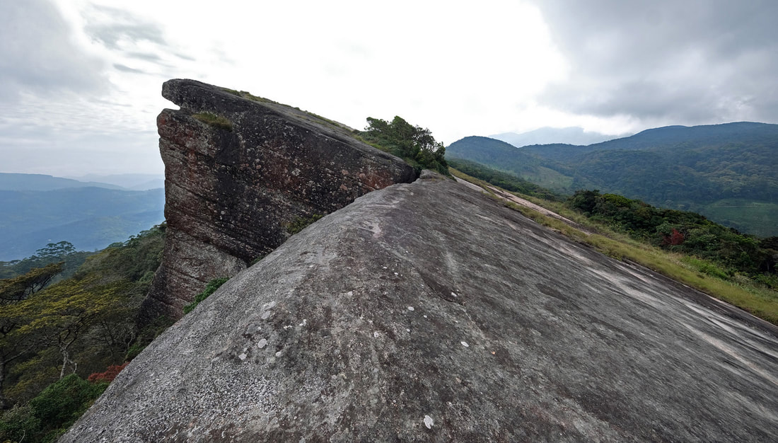
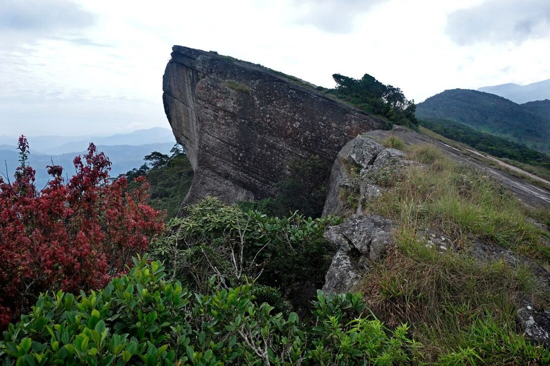
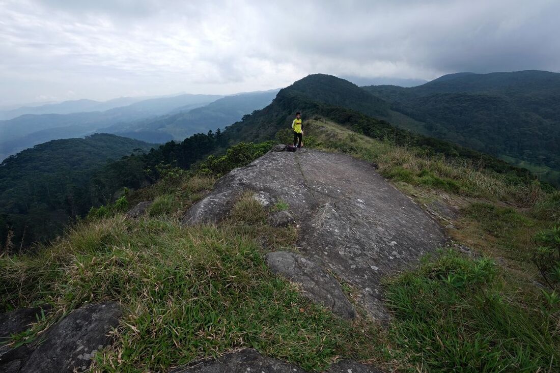
From the ruins of James Taylor's former bungalow, the rest of the hike is only 500 m (1600 feet) long. However, it will take 15 to 20 minutes because the uhill path is quite steep, though perfectly well walkable. You will be walking below the eastern esparpements for a while, before finding the final and steepest uphill part, which reaches the top at the southern end of the Kondagala rock, which has a flat surface. The main rock is more than 200 m (almost 700 feet) long from north to south and up to 70 m (200 feet) wide. However, the rock surface stretches even further in a lower terrace to the north, altogether more than half a kilometer (a third of a mile) long.
From the ruins of James Taylor's former bungalow, the rest of the hike is only 500 m (1600 feet) long. However, it will take 15 to 20 minutes because the uhill path is quite steep, though perfectly well walkable. You will be walking below the eastern esparpements for a while, before finding the final and steepest uphill part, which reaches the top at the southern end of the Kondagala rock, which has a flat surface. The main rock is more than 200 m (almost 700 feet) long from north to south and up to 70 m (200 feet) wide. However, the rock surface stretches even further in a lower terrace to the north, altogether more than half a kilometer (a third of a mile) long.
Be cautious: Because of the 90-degree escarpment forming the abrupt end of the rock surface, which is almost flat with only a very moderate slope to the other (western) direction, Kondagala is dangerous. There are no railings or warning boards near the escarpment. And winds can be very strong and surprisingly gusty here.
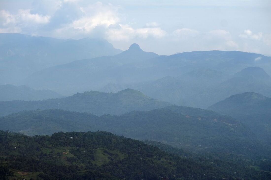
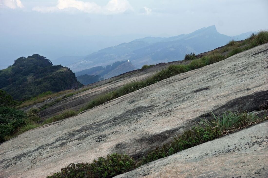
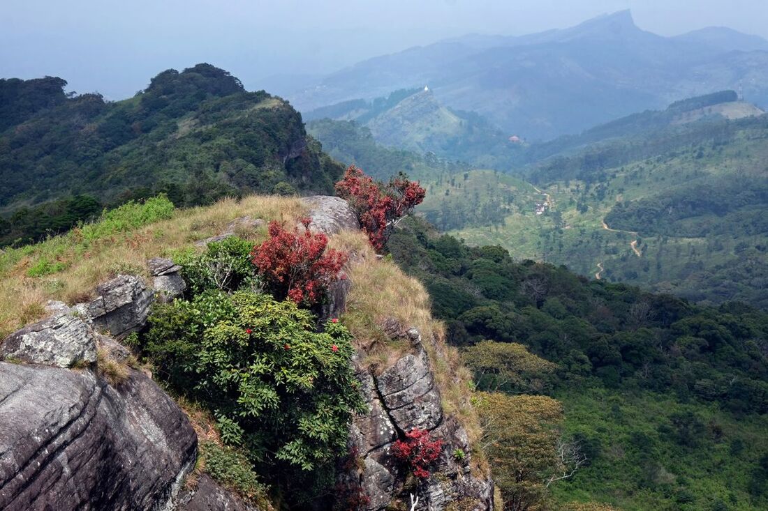
Not surprisingly, Kondagala is an excellent viewpoint. To the southern direction, you can easily recognize the sharply triangular double peaks of Katusukonda and Urugala, which are the highest points of Kandy's Hanthana mountain Range. In front of them, slightly to the left, one hill is crowned by a large white stupa dome. This is Bhadravathi near Galaha. To the west and to the southeast alike you see the valleys formed by the Mahaweli Ganga, which is the by far longest river of Sri Lanka, winding in a large slope around Kandy. To the east you can spot the Kukulugala Range, which is between Kondagala and the Randenigala reservoir of the Mahaweli Valley. (Don't confuse Kukulugala Range of Kandy District with Kukulagala viewpoint near Welimada in Badulla District.) Ambuluwawa Mountain, the famous backyard mountain of Gampola, can be seen almost exactly to the west of Kondagala, in 19 km (12 miles) distance, as the crow flies. The forested mountains of the central range of Sri Lanka's highlands, seen in the southern direction, belong to the area of Chariot Path and culminate in Pidurutalagala near Nuwara Eliya. The range stretching from there in an eastern direction, which can be seen from Kondagala in the southeast direction, comprises Rawana Pathana in the area of Harasbedda.
Not surprisingly, Kondagala is an excellent viewpoint. To the southern direction, you can easily recognize the sharply triangular double peaks of Katusukonda and Urugala, which are the highest points of Kandy's Hanthana mountain Range. In front of them, slightly to the left, one hill is crowned by a large white stupa dome. This is Bhadravathi near Galaha. To the west and to the southeast alike you see the valleys formed by the Mahaweli Ganga, which is the by far longest river of Sri Lanka, winding in a large slope around Kandy. To the east you can spot the Kukulugala Range, which is between Kondagala and the Randenigala reservoir of the Mahaweli Valley. (Don't confuse Kukulugala Range of Kandy District with Kukulagala viewpoint near Welimada in Badulla District.) Ambuluwawa Mountain, the famous backyard mountain of Gampola, can be seen almost exactly to the west of Kondagala, in 19 km (12 miles) distance, as the crow flies. The forested mountains of the central range of Sri Lanka's highlands, seen in the southern direction, belong to the area of Chariot Path and culminate in Pidurutalagala near Nuwara Eliya. The range stretching from there in an eastern direction, which can be seen from Kondagala in the southeast direction, comprises Rawana Pathana in the area of Harasbedda.
Climate and best time to visit Kondagala
The best time to visit Kondagala rock is the very early morning. But Kondagala is both a sunrise and a sunset point. The winds can be strong and, particularly in the morning, the temperatures can be quite cool, though almost never below freezing point.
The seasonal climate differences are not very large. Meteorologically, there are two rainy seasons, most rainfall is from October to December, a second peak of precipitation is in April. The driest periods are around February and again around August. Actually, you can have good luck to enjoy favourable conditions for hiking to Kondagala in every month of the year. But the flipside is: You should be aware, that you can have bad weather conditions in each month, too. In Sri Lanka's central highlands, there is generally a considerable amount of fog and rainfall even during months that typically experience dry weather.
The seasonal climate differences are not very large. Meteorologically, there are two rainy seasons, most rainfall is from October to December, a second peak of precipitation is in April. The driest periods are around February and again around August. Actually, you can have good luck to enjoy favourable conditions for hiking to Kondagala in every month of the year. But the flipside is: You should be aware, that you can have bad weather conditions in each month, too. In Sri Lanka's central highlands, there is generally a considerable amount of fog and rainfall even during months that typically experience dry weather.
