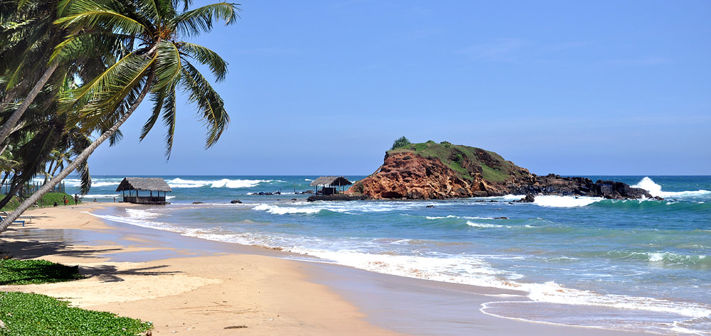
With almost 1600 km of coastline, Sri Lanka seems to be the perfect destination for beach holidays. Indeed, the island has many advantages for holiday makers who are interested in beach relaxation in the first place. Sri Lanka has a variety of beaches for different puposes, for sports and fun as well as for nature expeditions, for meeting locals or enjoing all-inclusive club holidays.
|
Scroll down to find a presentation
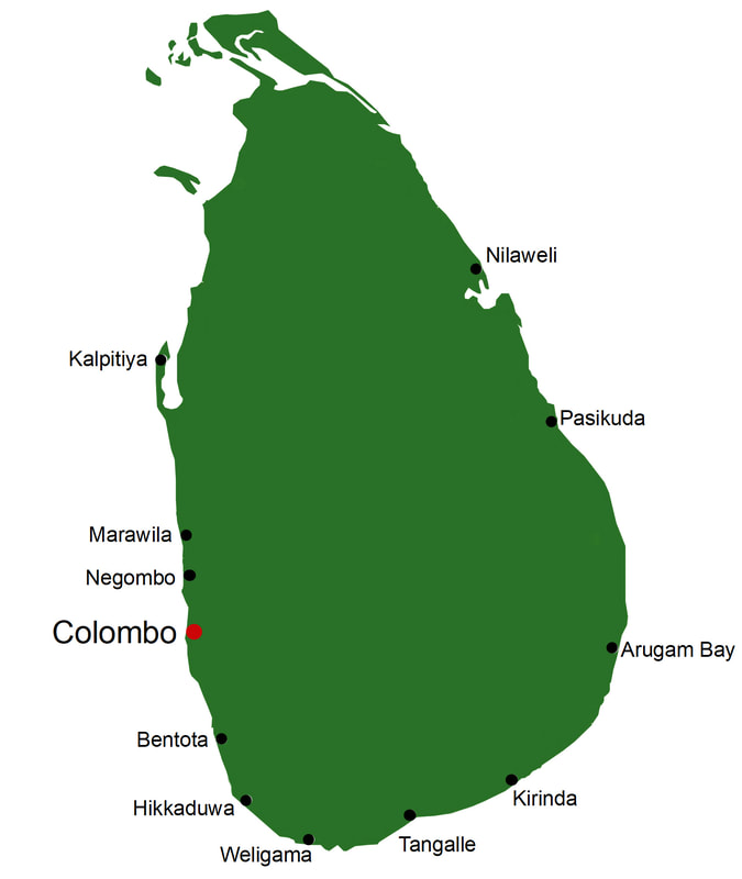
of numerous beaches below, sorted counterclockwise, or click on the names here: north and northwest: Thalaimannar Kalpitiya Marawila Negombo southwest: Beruwela Bentota Balapitiya Hikkaduwa |
south:
Unawatuna - Weligama - Mirissa - Dondra - Hoomaniya - Hiriketiya - Tangalle - Ussangoda - Hambantota - Kirinda - Yala
Unawatuna - Weligama - Mirissa - Dondra - Hoomaniya - Hiriketiya - Tangalle - Ussangoda - Hambantota - Kirinda - Yala
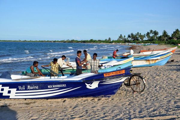
In one regard at least, Sri Lanka is the perfect tropical island for beach relaxation: Because the western and the eastern coast belong to completely different and contrasting climate zones, there can be found a suitable beach resort with lots of sunshine for every month of the year. The dry season and peak holiday season at the traditional beach holiday destination along the south-western coastline between Negombo and Galle is between Christmas and Easter Holidays, whereas the newly developed or redeveloped East Coast beaches of Nilaweli near Trincomalee, Pasikudah near Batticaloa and near Pottuvil enjoy their local dry season and perfect weather conditions during the northern hemisphere summer months. In other words: Whenever you ike to come to Sri Lanka, there will be a beach with a blue sky waiting for you in one or another part of the island. For example those guests interested in water skiing, banana boat rides, windsurfing or other water sports or fun activities, can enjoy it in Bentota during northern hemisphere winter months or in Pasekudah during summertime. On the other end of the scale, there are many attractive beaches for independent travellers. Hikkaduwa, Unawatuna and Mirissa are popular with backpackers in the summer months, wheres Arugam Bay, Sri Lanka's best surfing spot, has the opposite high season, from April till October. In contrast for example to Vietnam, there are still long stretches of Sri Lanka's coastline completely untilled and without any tourism. They can be reached on day trips or on camping tours. Even Sri Lanka's safari guests can spend their nights at the beach.
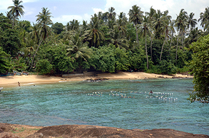 protected pristine beach near Dondra
To be honest, there are also disadvantages. Swimming is dangerous at many stretches of Sri Lanka's coastline, due to underwater currents. Families should prefer protected coves such as Unawatuna or shallow beaches such as Pasekudah. Another disadvantage of Sri Lanka's southwestern beaches is that most of them are very close to the noisy A2 mainroad. People looking for undisturbed beaches during the peak season should prefer locations to the north of Colombo, for example Kalpitiya island, another newly developed holiday destination. Besides many pristine beaches, Kalpitiya offers two very different kinds of attraction, kitesurfing and dolphin watching. Sometimes whales can also be spotted on the same boat tour. However, Sri Lanka's best whale watching beach is definitely Mirissa, during the winter months. Summertime is whale watching season in Trincomalee at the East Coast, The big advantage of beach holidays in Sri Lanka is: You can enjoy much more than beach fun, many cultural heritage and natural adventure attractions are within day-trip distance.
Sri Lanka's beaches, all around the island, are listed conterclockwise below,
starting just south of capital Colombo, finishing at Negombo close to the airport again:
starting just south of capital Colombo, finishing at Negombo close to the airport again:
Beruwela - harbour of medieval Serendip
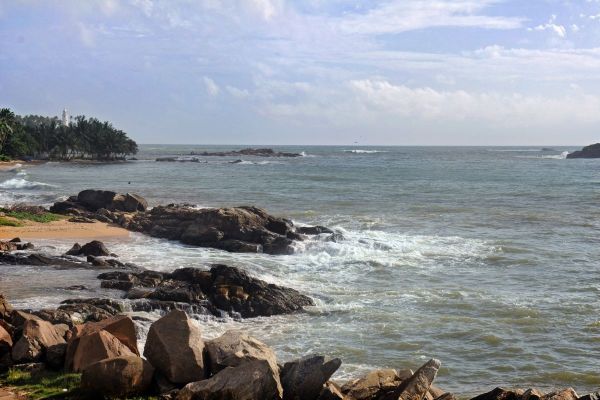
Beruwala, a town in Kalutara District, a renowned beach holiday destination at Sri Lanka's tropical southwestern cost, about 60 km south from Colombo. The shoreline of Beruwela is more than 5 km long, it consists of several beaches. The main hotel area is at the wide sandy beach of Moragalla dn the southern part of the town and in the adjacent village of Aluthgama. The sea is excellent for swimming, except from the monsoon season (June to September). Beruwela's major tourist attractions are situated at the northern end of town, namely the lighthouse on Barbaryne Island, the fishing harbour, where fresh catch brought by the colorful fishing boats early in the morning, and Kechimalai mosque, Sri Lanka's oldest Muslim prayer house, on a hill overlooking the harbour. Bentota has a population of about 33,000 locals, primarily Muslims, many of them are gem merchants. Read more...
Bentota - Sri Lanka's beach for watersports
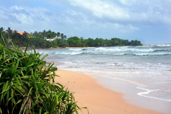
Bentota is Sri Lanka’s favourite beach for those who like to spend relaxing holidays in a comfortable resort and to enjoy a wide range of sports and fun and Ayurveda. Bentota, a coastal town in Galle District, situated on the southern bank of the Bentota Ganga river mouth, the northern part of Bentota is a peninsula in between the ocean and the river. Among Sri Lankans, Bentota is famous for toddy production. Bentota is a tourist attraction in itself. Though safari lovers and cultural tourists rarely spend a long period in this southwestern coastal region of Sri Lanka, the hinterland of Bentota is crowded with natural and cultural attractions. Indeed, there are neither national parks nor ruins of ancient temples close to Bentota. Nevertheless, the range of attractions is wide, mangroves, turtle hatcheries, toddy tapping, spice gardens, landscaped gardens, mask museums, moonstone mine. Read more...
Balapitiya
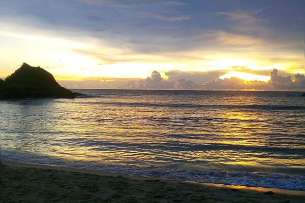
Balapitiya on the southwest coast is a suburb of Ahungalla in Galle District. Balapitiya Beach is situated on a spit between the open sea and the wetlands of Madu Ganga, which have developed into the most popular location of boat tours crossing mangrove swamps and visiting the islet called Cinnamon Island. This is to say, travelers who like to go on a boat safari, for which the early morning and late afternoon hours are most recommendable, should consider an overnight stay in Balapitiya or in Ahungalla slightly further north. Ahungalla is famous for a resort designed by Sri Lanka's most celebrated architect, Geoffrey Bawa. Balapitiya itself has two different beaches which are separated by a scenic outcrops called Balapitiya Beach Rock. Only the 700 m long sandy beach to the north of it is Balapitiya beach in a narrow sense. Read more...
Hikkaduwa
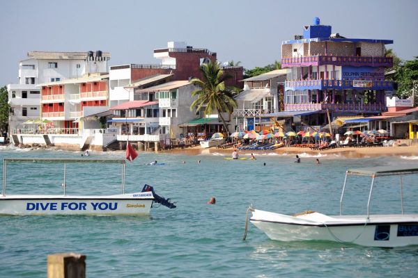
Hikkaduwa is a coastal town popular with backpackers. In the early 70th, it became famous as Sri Lanka's hippie beach. Hikkaduwa is situated 17 km northwest of Galle. The busy A2 main road from Colombo is crossing the center quite near to the beach. Hikkaduwa is well known for at least three reason. It‘s a popular destination for its night life. It is the best surfing spot at Sri Lanka‘s southwestern coast. It has the only glass bottom boats for coral reef sightseeing. Though the Hikkaduwa Coral Sanctuary is said to have seventy varieties of multi-coloured corals, much of it is damaged and it‘s less worth seeing than coral reefs in other parts of the world. The small sanctuary is just a little extra for holiday makers and protecting parts of the beach and offering a long stretch of shallow water more suitable for children than other southwestern beaches. Surfing and diving schools are available. Read more...
Unawatuna - loveliest south coast beach
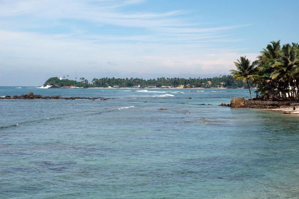
Unawatuna is one of Sri Lanka's mcst popular beaches with independent travellers. Situated only three kilometres of World Heritage Site Galle, Unawatuna is one of the few the crescent-shaped bays along the southwestern coast of the island. The sea is generally calmer in Unawatuna and safer for swimming than elsewhere at Sri Lanka's coast. A small reef shelters the beach and also harbours plenty of fish. That's why there are many diving centres at Unawatuna beach. Snorkels and masks can be borrowed at some guesthouses, too. Unwatuna is also a good destination for Ayureveda holifays. In 2004, Dicovery Channel rated Unawatuna Beach as one of the ten best beaches in the world. The hills along the coastline between Unawatuna and Galle are known as Rumassalla. Locals believe, that it a part of the Himalayas which fell down, when Hanuman transported a mountain through the air. Read more...
Weligama - with Taprobane Island
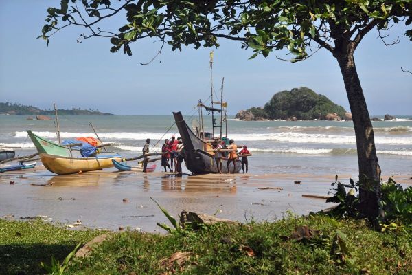
Weligama literally means "sand village". Indeed, Weligama has a 4 km long sandy beach. The cove of Weligama, framed by red laterite outcrops, is crescent-shaped, but less well protected than Unawatuna beach. Legend has it the Weligama was the beach where the first coconut was washed ashore in Sri Lanka. Apart from destinations and activities in its surroundings, there are three main attractions in Weligama. One is stilt fishing, a traditional fishing method centuries ago. Today's stilt fisher do it for collecting tips more than for selling fish. Most stilts can be seen along the coast between Weligama and Kogalla. Another special attraction of Weligama is a boutique hotel on the small islet islet called Taprobane. The villa was constructed by the French writer Count de Mauny. Within walking distance from Weligama's beach is a heritage attraction, a the rock-cut statue called "Kustaraja", "Leper King". Read more...
Mirissa - Number One for Whale Watching
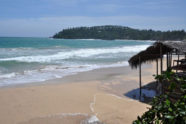
Just 6 km east of Weligama, at the opposite side of the Polwatta River, is the beach of Mirissa. After Hikkaduwa and Unawatuna, it became the next insider beach of backpackers. But in the meantime, it is well-known and attracting many visitors. The waves are higher than in Unawatuna. That's the reason why Mirissa is more popular with surfers. In recent years, Mirissa has become Sri Lanka's number one destination for whale watching boat tours. Indeed, it has a reputation to be one of the best whale watching sites of the world, because both Blue Whales and Sperm Whales can often be seen on the same boat tour.
Big observation boats for three dozens of passengers and speed boats for a maximum of ten persons are available. Tours start in the very early morning around 6 or 7 o’clock and last about 4 hours. Whale watching season in Mirissa is from December to April, end of March is best. Read more...
Big observation boats for three dozens of passengers and speed boats for a maximum of ten persons are available. Tours start in the very early morning around 6 or 7 o’clock and last about 4 hours. Whale watching season in Mirissa is from December to April, end of March is best. Read more...
Dondra Head - southernmost tip of the island
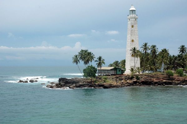
The name "Dondra", an anglicized abbreviation of the Sinhala name "Devundara", is probably derived from the Sinhala "Devi Nuwara", which means "Goddess City", or from the Tamil "Devan Thurai", meaning "God's Port". Indeed, Dondra had once been the location of a famous temple, presmubly one of the major five Ishvaram temples of the island, of which only four are identified. The Dondra temple was destroyed by fanatic Christians from Portugal. A new Buddhist Vihara with a replica of the Aukana Buddha statue is close to the coastal mainroad, where the side road to Dondra head branches off. Dondra Head is the name of a small cape. The latitude of Dondra Head is 5.936 north. It is crowned by the Dondra Head Lighthouse, commissioned in 1890. The southernmost tip of Sri Lanka is only 500 m further southeast. It's called Dragon Mouth, its latitude is 5.9187 north. Read more...
Hoomaniya Blowhole - near Dikwella
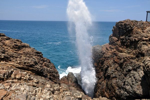
Hoomaniya, also spelt "Hummanaya", is an onomatopoetic name imitating the noise of the "exploding" pseudo-geysir. The correct name of the natural phenomenon is blowhole or, in Britain, gloup. Blowholes are openings of sea caves in some distance to the coastline. Actually, blowholes are even rarer than geothermic geysers. Sri Lanka's only blowhole is located close to Dikwela, between Matara and Tangalle. The eruptions can reach heights of up to 18 metres, making it the third largest in the world, after Kiama Blow Hole (25 m) in New South Wales, Australia, and La Bufadora ( 20 m) on Mexico's Baja California peninsula. ther blowholes are known from New Zealand, Samoa, Tonga, Tahiti, Hawai, which has two very impressive ones, Barbados, and the British Isles. Be aware, blowholes are dangerous. Several fatal accidents happened, when persons came too close to the Hoomaniya Blowhole. More about the blowhole...
Hiriketiya Horseshoe-shaped Beach - for surfing classes
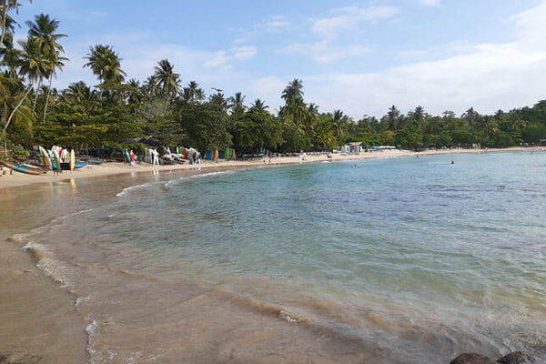
Hiriketiya Beach, situated 1 km east of the much larger Dickwela Beach, is one of Sri Lanka's very few sandy beaches that are crescent beaches with an opening to the sea that is narrower than the width of the beach. In other words, Hiriketiya is a cove in the form of a drop falling from the ocean further inland. Or to coin it in one word: horseshoe-shaped. There is another distinct feature which has this beach made increasingly popular in recent years: Hiriketiya is one of the few beaches along the southwestern and southern shores of Sri Lanka without busy roads close-by and without a lot of cement buildings. The nearby much larger Dickwella Beach is safe for swimming too, but not as pristine. Hiriketiya comes close to picturebook holiday dreams of a palm-lined beach. Hiriketiya is also known as one of Sri Lanka's best surf spots, with a break suitable for beginners within the protected cove and breaks demanding medium surf skills at the opening of the cove. More about Hiriketiya surf spot...
Tangalle - fishing harbour
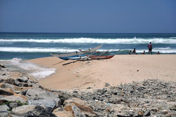
Tangalle is also spelt "Tangalla". The Sinhala name means "protected rock". Tangalle is a fishing harbour in the western part of Hambantota District. Close to the port is a small stretch of sandy beach, usually visited by locals only, though Tangalle has simple guesthouses, too. To the west of the town is a choice ofl coves with upmarket and boutique hotels and Ayurveda facilities. To the east is the protected area of the long Rekawa beach, famous for turtle watching, and the Kalamitiya lagoon, belonging to the bird sanctuary of the same name. Apart from the beaches, there are some attractions in the hinterland of Tangalle, for example the Mulgirigala rock monastery with painted cave, it likes to be called the "Sigiriya of the South" due to its rock and the "Dambulla of the South" because of its murals. Udawalawe national Park, famous for elephant safaris, is within day-trip distance from Tangalle. Read more...
Ussangoda - a small national park
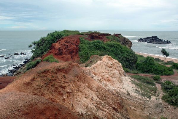
Ussangoda is a remote coastal strip in the area of Ambalantota. Bathing at the tranquil beaches is dangerous because of high waves and strong currents. Ussangoda is a barren land, quite unusual at the shores of Sri Lanka. Folk tales have it, that Ussangoda Rock came as a meteor or that it was burnt, when Hanuman's tail was set on flames, a famous Ramayana episode. Ussangoda became national park in 2010. With only 3.5 square kilometres, it's one of Sri Lanka's smallest national parks. The area is protected for its very rare flora. Besides small pockets of pigmy forest, Ussangoda rock is only covered with grass. But these grass species occur only on so-called "serpentine" soil. This is a natural soil with a high concentration of poisonous heavy metals. There are only four more serpentine areas in Sri Lanka, but smaller. The grasses of Ussangoda have special characteristics found nowhere else in the world. Read more...
Hambantota - the new commercial hub
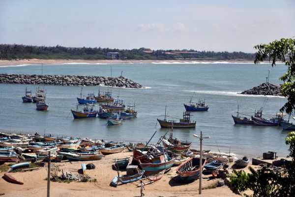
Hambantota had been a quiet small coastal town, until Sri Lanka's former president Rajapakse, who is from Hambantota District, began huge-scale projects to develop Hambantota into Sri Lanka’s second urban hub. With Chinese support, a new deep sea port was opened in November 2010. It does not disturb the bay further east, where the traditional fishing harbour is and Hambantota's only beach hotel complex are situated, the "Peackock Beach Hotel". The name “Hambantota” is derived from the word “Sampan” for boats from Southeast Asia. “Thota” means anchorage. One of Sri Lanka's Muslim minorities, the so-called "Malays", settled - or were settled - in this are under Dutch colonial rule. Further migrants arrived from the Malay peninsula during the British colonial period. One of the admistrators of Hambantota was Leonard Woolf, later on husband of Virginia Woolf. Read more...
Kirinda - starting point for scuba diving adventures
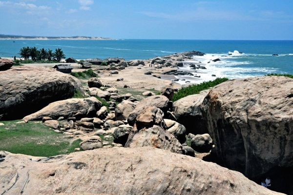
Kirinda, 1o km south of Tissamaharama, is situated in between Yala and Bundala national parks. A white dagoba is Kirinda's landmark. It marks the spot where princess Viharamahadevi stranded in a golden boat. Though a picturesque sandy beach framed by rocky outcrops, Kirinda is not crowded with tourists, because underwater currents are quite dangerous here. Kirinda nevertheless is well-known to a specific kind of adventure tourists. Kirinda is by far the best place for scuba diving in Sri Lanka, though only for very experienced divers. Visible offshore are the Basses reefs, where several historical ships ran onto ground and sank. Actually, the wrecks were finding places of significant treasures. One famous explorer of Kirinda's Basses reefs was Arthur C. Clarke, the famous author of science fiction novels. The best season for scuba diving at the two Basses Reefes is in March and April. Read more...
Patanangala Beach - in Yala National Park
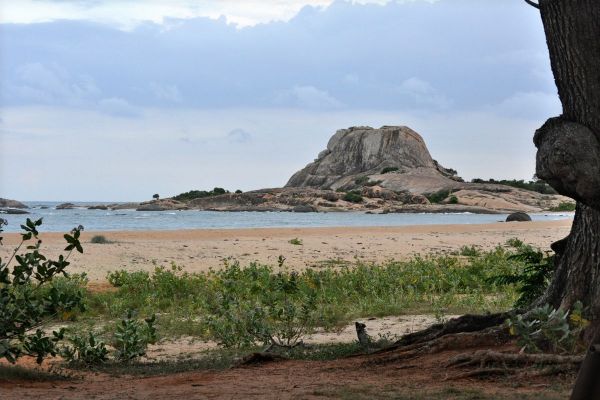
Patanangala is a metamorphic rock outcrop near the eastern end of Block 1 of Yala National Park, in only 4 km distance from the former village called Yala and the river mouth of the Menik Ganga, which forms the border to Block 2 of the National Park. Patanangala, situated on a promotory at the southern tip of the Yala Beach, is the landmark rock of Yala National Park's coastline. Yala is one of the few national parks offering the opportunity to combine several-day animal watching adventure tours with overnight stays at the beach amidst the wilderness.That's the reason why Patanangala Beach was popular with safari tourists, until the bungalow was demolished in the 2004 Boxing day Tsunami. 47 people lost their lives. The house is still in ruins. A memorial has been erected at Patanangala Beach, with a steel monument representing towering waves. A stone inscription explains what happened. Read more about Yala...
Okanda - off-the-beaten-path beaches
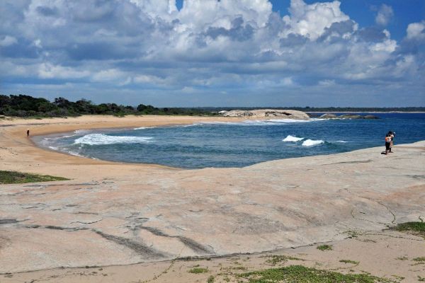
If you are looking for lonely beaches, Okanda will be worth a visit. Okanda is located 20 km south of Arugam Bay, at the eastern entrance gate of Kumana National Park and close to the scenic heritage site Kudumbigala. Okanda is part of coastline that until now remained free of hotels and traffic and pollution. Often you can walk kilometres along the beaches near Okanda without meeting anyone. Bathing is dangerous because of high waves and strong currents. Okanda is not as perfect for surfers as Arugam Bay, but they cover their expenses here, too, and they will remain undisturbed. In July, Okanda is a busy place for a few days, because it is the last station for the annual pilgrimage from Jaffna to Kataragam. Sri Lanka's most significant pilgrimage route runs along the eastern shores of the island till Okanda. The pilgrims take ritual bathes in the ocean near the Hindu temple at Okanda beach. Read more...
Arugam Bay - Surfer's paradise
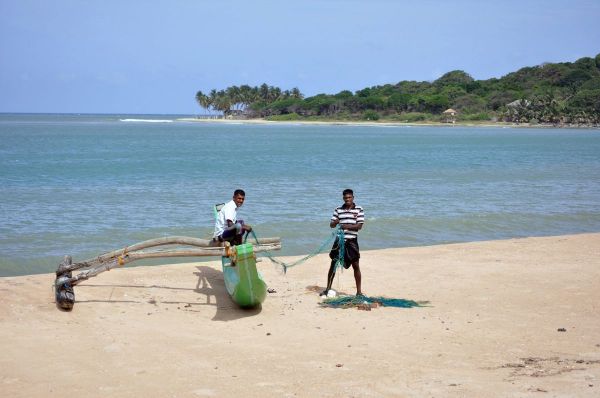
Arugam Bay is still a place where you can meet local fishermen, though it has become the East Coast's hub for backpackers in general and surfers in particular. Arugam Point is regarded as the best surf spot of Sri Lanka. Surfing season is from April till October, which is the local dry season, too. Arugam Bay is suitable for beginners. The waves are not record-breaking, but experienced surfers can enjoy very long rides. Arugam Point is within walking distance of the accommodations in Arugam village There are several more quality surf breaks within driving distance, for example "Whiskey Point" to the north and "Elephant Rock" to the south. Arugam is quite a relaxed place, with simple guest house accommodation. Arugam Bay is also visited by young Sri Lankan holiday makers and can be quite noisy in the weekend. Arugam Bay it the normal starting point for half-day safaris in Kumana national park. Read more...
Pottuvil - the East Coast's largest dune fields
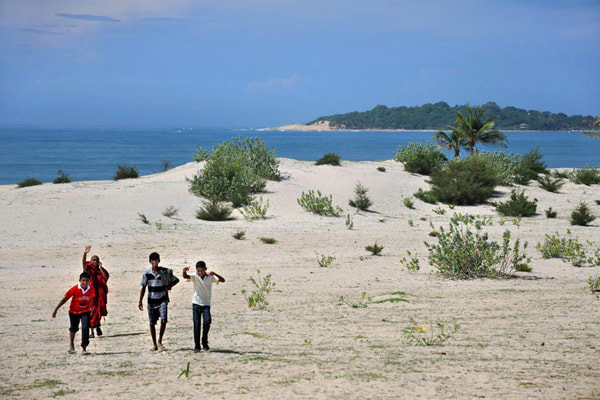
Pottuvil is a coastal town in the eastern province rarely visited by holiday makers, though there are many interesting places in the surrounding. In the immediate vicinity of Pottuvil are two sand dune fields that are the largest in Sri Lanka, namely Pottuvil Point, a kind of peninsula between the open sea of the Bay of Bengal and the Pottuvil Lagoon, and, protecting the city from encroachment and closer to the Arugam Lagoon in the south, there is another area of high dunes. Just in between these two vast sandy beaches is Kottukal Beach House operated by the Jetwing Group. The eastern coast of Sri Lanka contains the longest stretch of sand dunes in the country. The Pottuvil sand dunes are a part of a sand dune series extending from here to Panama further south. At the white sand of the Pottuvil is the historic Mudu Maha Vihara, parts of the ancient site are buried beneath the white sands. Read more...
Thirukkovil - long stretches of untouched beaches
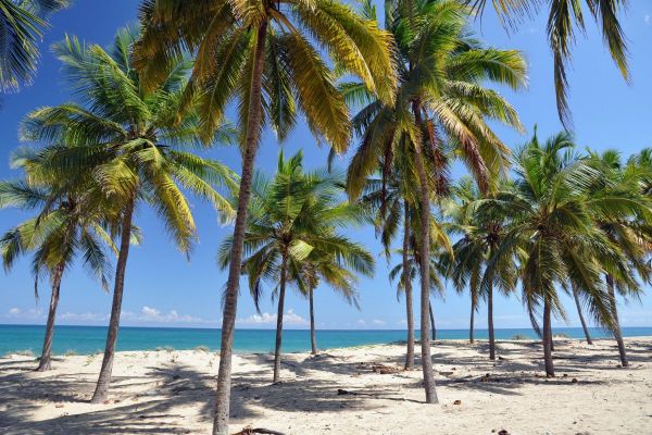
There are still coastlines in Sri Lanka that remain without tourist infrastructure and are completely untouched. Between Kalmunai and Pottuvil, the largest coastal towns of Batticaloa and Ampara District respectivley, there is almost no hotel or guesthouse available. An exception to this rule is the Thompukandam Village Resort near the campus of the South Eastern University at Oluvil, not from from Digavapi. Along Sri Lanka's East Coast, there are many shrines dedicated to Murugan alias Kataragama, connected by the Pada Yatra pigrimage route. One of them is the Citra Velayudha Swami Kovil in Thirukkovil. This Tamil word simply means "Holy Temple". The god is venerated here in the form of his spear, Vel. This temple is the common temple for "Mattakkalappu Desam", that's the name of this entire littoral of Batticaloa and Ampara Districts. Thirukkovil is also a place of worship for local Wedda tribes. Read more...
Kalmunai - largest town at the East Coast
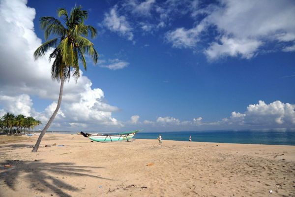
Kalmunai in Batticaloa District is the largest town in the Eastern Province and Sri Lanka's third largest city outside Colombo District, only Negombo in the west and Kandy in the centre of the island have more inhabitants. More than 100,000 people live in this East Coast city. Kalmunai has long sandy beaches just in between the city centre and the ocean. Surprisingly, there are no hotels in this area. Kalmunai has an interesting history. It is Sri Lanka's only large municipality with a Muslim majority. Muslims had lived in peace in Sri Lanka until the Portugues Christians invaded the island. The colonialists expelled Muslims from Colombo. The desparate community took refuge in the Sinhalese Kandy Kingdom. King Rajingha II decided to resettle 8000 of them in Kalmunai and a smaller group in Kattankudy. For this purpose, the Buddhist King gave his own land. Read more...
Pasikudah - Sri Lanka's new summer beach holiday destination
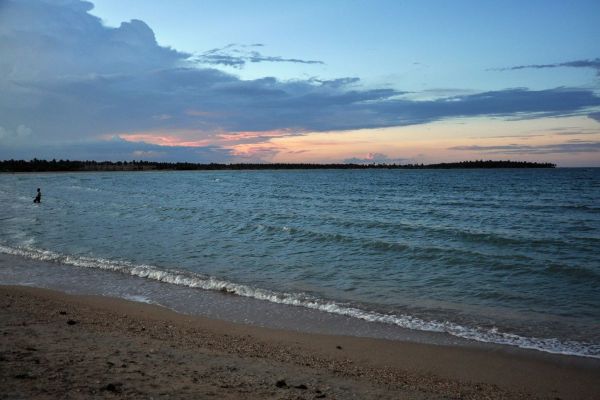
In recent years, Pasikudah and neighbouring Kalkudah have become the main tourist destination of Batticaloa District. Compared to Nilaweli, Pasikudah has higher category hotels. It has become a popular family holiday resort in the first place, amongst locals and foreigners alike, because Pasikudah is known to have one of the longest stretches of shallow coastline in the entire world, allowing to walk far into the sea, perfectly safe for children. Watersport activities in Pasikudah include windsurfing, water skiing, jet scooters, banana boat rides, and diving. To the north, the Vakarai lagoon is interesting for birdwatchers. World Heritage Site Polonnaruwa and Fort and Hindu temples of Batticaloa are within half-day excursion distance. Thoppigala (Kudumbimalai) nature reserve, where the spectacular needle rock can be climbed easily, is even closer, it can be reached using footbikes. Read more...
Thennadi Bay - traditional Tamil fishing techniques
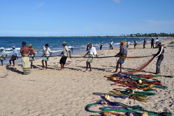
Thennadi Bay is situated only 10 km north of Pasikudah, beyond Velaichchenai Lagoon and a promontory called Elephant Point. There is no touristic infrastucture at all at Thennadi Bay, only local fishermen live here in the village of mankerni. Thennadi Bay offers an opportunity to observe the genuine seining fishing, practiced for example by the "singing fishermen" of Kerala in India, too. Locals use nets made of coconut fibre or nylon beach seining. Setting a net in the ocean and hauling it up onto the beach manually by its two ends is one of the oldest methods of catching fish. It it is still employed in Sri Lanka, particularly by Tamil fishermen communities. Half a century ago, beach seining was the most significant single method of fishing. Several hundreds of beach seines were operated by thousands of Sri Lankan fishermen, contributing 35-40% of the island's total annual fish catch. Read more...
Nilaweli - resort with Sri Lanka's longest sandy beach resort
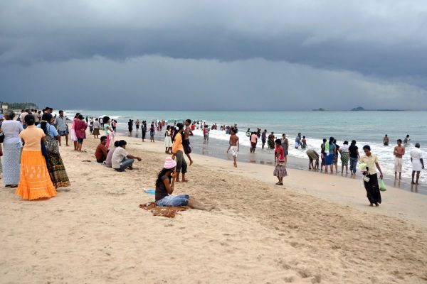
Nilaweli beach is situated at Sri Lanka's eastern coast about 16 km north of Trincomalee, capital of Sri Lanka's Eastern Province. With a 10 km long stretch in a straigt line and strikingly white sands, Nilaveli is considered one of Sri Lanka’s most perfect beaches. Nilaweli, often spelt "Nilaveli" means "Blues sands" in Sinhala, but, more poetic, "Open land in the moonshine in Tamil. Since the end of the civil war in 2009, Nilaweli saw a significant increase in the number of tourists and accommodations. Today, Nilaweli offers more 3-star hotels than any other beach resort at the eastern coast. Pigeon Island, one of Sri Lanka's small marine national parks, is a popular boat trip destination. Apart from the Hindu pilgrimage sites auch as Trincomalee's Konesvaram Temple and Kinniyai hot wells, there are also places of interest for heritage tourists within half-day trip distance, Thiriyai and Velgam Vehera. . Read more...
Kuchchaveli - lonesome long beach
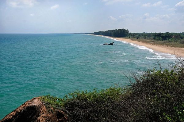
Just north of Nilaveli is another long sandy beach, Kuchchaveli, which is rarely visited by foreign visitors, except from guests of one of the best hotels far and wide, which is located at the southern end of the long Kuchchaveli beach, not far from Nilaveli. However, there is a reason why it's less popular than neighbouring Nilaveli Beach. Kuchchaveli Beach is not safe for swimming, because it's less protected by promontories and underwater currents can be strong. However, Kuchchaveli is a rewarding destination for half-day excursions from Trincomalee or Nilaveli, not only for lonesome beach walks. There are several abcient sites in the surroundings of Kuchchaveli, two of them are easy to reach, namely Samudragiri Pichchamal Viharaya, which is located on a rock directly at the beach, and Samudragiri Wana Senasuna, which is one of the best viewpoints in this coastal region. Read more...
Arisimale - the hidden cove
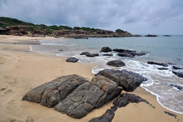
Travellers searching for a pristine beach, in order to avoid the crowds of Nilaveli, will find pleasant coves further north. In about 40 km distance is Arisimale Beach (Arisimalai) near Pulmoddai. It can only be reached on a small trek through a forest. It's far away from any noisy roads. "Arisi" is the Tamil "word" for "rice". Notably, the English word "rice" is derived from the Tamil language, similar to "pepper". "Malai" is a common Indian name for "hills". hence "Arisimale" literally means "Mount Rice". The name refers to the unusual large size of the grain of sand at this beach, almost the size of rice grain. Arisimalai is a small cove, protected by rock promontories. The waves can be high, but it's a perfect place for bathing in the ocean, indeed. The much longer beach of Pulmoddai is not as recommendable, it is more industrialized. The northern part of the bay has valuable mineral sands, which are exlpoited here. Read more...
Thalaiyadi - at Sri Lanka's longest stretch of sandy beaches
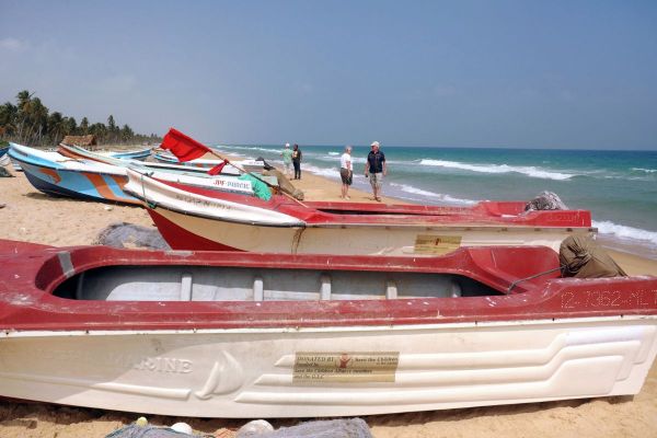
Thalaiyadi at the northeastern coast of Jaffna Peninsula is part of Sri Lanka's longest strip of sandy beaches and sand dunes. This northernmost region of Sri Lanka is called Vadamarachchi, also spelt Vadamaradchi. It's one of the three historic divisions of Jaffna Peninsula. The Vadamarachchi Lagoon, which is also called Thondamannar Lagoon, separates it from the other divisions. Administratively, Vadamarachchi consists of three divisional secretariats, two of them form the northern part, including Point Pedro, a densely populated area, whereas the third one, Vadamarachchy East, has only 16000 inhabitants. Vadamarachchy East is the long strip of dunes mentioned above. It stretches more than 50 km from Manalkadu in the northwest to Chundikkulam in the southeast. There is almost no touristic infrasturcture in this region and foreign visitors are very rare at the long beaches. Read about nearby Manalkadu...
Thalaimannar - mythical bridge to India
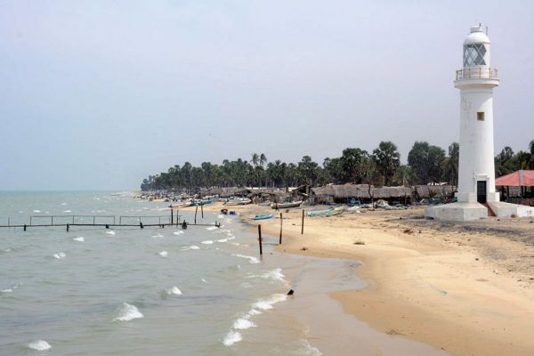
Talaimannar at the northwestern coast of Mannar Island is the village which is situated closer to India than any other in Sri Lanka. India's Danushkodi Point is in only 32 km (20 miles) distance. Talaimannar is famous for its pier, which is located close to the terminus of the railway Colombo-Mannar line. A ferry service to India's Ramesvaram Island was operated from here until 1964, when a cyclone caused severe destructions. The Palk Bay between India and Sri Lanka is very shallow, and a sandbank forms a chain of small islets between India's Ramesvaram Island and Sri Lanka's Mannar Island. The mythical connection with India is known as Adam's or Rama's bridge. Talaimannar is one of Sri Lanka's kitesurf destinations. The 19 m high Mannar Island Lighthouse at the beach of Talaimannar was built in 1915. It was not operated during some years of the civil war. Read more...
Kalpitiya Peninsula - dolphin watching and kite surfing
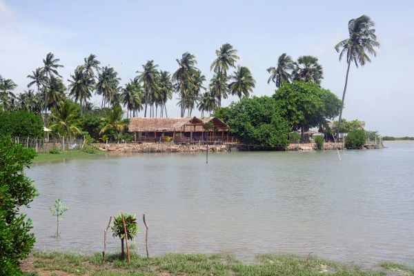
Kalpitiya is a peninsula close to Puttalam in northwestern Sri Lanka. It has been developed as a new travel destination only in recent years. Guest houses are available now at the northern and western seashores of Kalpitiya. Besides plenty of sandy beaches, Kalpitiya Peninsula's main attraction is twofold. During the monsoon period in the summer month of the northern hemisphere, Kalpitiya remains dry but is windy. Due to the shallow waters of its lagoons and the wind conditions, Kalpitiya has become Sri Lanka's number one destination for kite surfing. For beginners, the winter months may be more suitable. However, the season between Christmas and Easter is perfect for another attraction. Kalpitiya Peninsula is Sri Lanka's best place for dolphin watching. Pods of more than 1000 dolphins can be seen on boat rides, whales can be spotted sometimes, too. More about kitesurfer destination Kalpitiya...
Marawila - Sri Lanka's all-inclusive destination
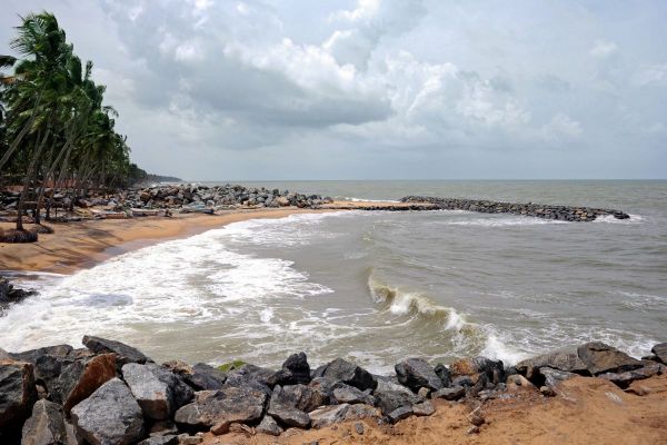
Marawila is located on the Northwest coast of Sri Lanka, 60 kilometers from Colombo. Its pristine sandy beaches stretch out many kilometres. For beach holidays at Sri Lanka's northwestern coast, Marawali is the best destination for all-inclusive tourism. Marawila's Club Palm Bay Hotel, a 4-star resort located in the fishing village Thoduwawa, is situated just in between the untilled seaside of Marawila and the Anankalliya Lagoon rich with biodiversity. Further inland, Marawila town at the Colombo-Puttalam mainroad is the number one location of Sri Lanka's Batik production. Some small family-run manufacturies allow visitors to study the production steps. Sri Lanka's Batik tradition is as ancient as that of Java. Marawila Beach is only 45 km away from the International Airport. Kalpitiya Island, renowned for water sports and Dolphin watching, is located 100 km further north. It can be reached within 1.5 hours. Read more...
Negombo - Oru fishermen beach
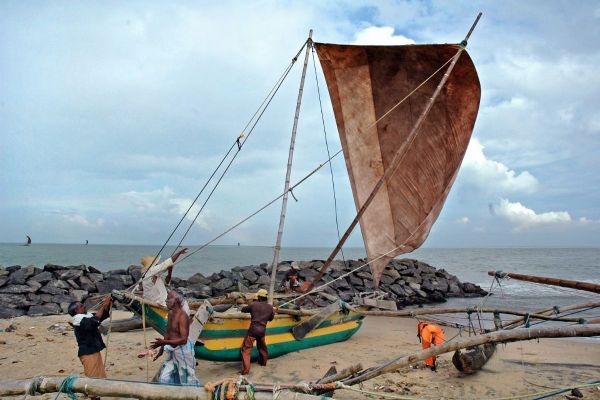
Negombo is Sri Lanka's beach closest to the airport, even closer than Colombo city. This is why many travellers spend their first nights in Negombo, starting their round tours from here. Negombo's Beach is not clean, and underwater currents are dangerous. In the weekend, Negombo is usually crowded and noisy. However, the Maha Oya river mouth only a few kilometres further north is a tranquil tropical paradise, and the Muthurajawela wetlands at the southern side of the Negombo Lagoon are worth a boat trip. Negombo has the largest fishing fleet of so-called "catamarans". Actually, the correct name would be "outrigger boat". The local name is "Oruwa". Many "Orus" offer private boat tours for foreign guests, on the rough ocean or inside the calm lagoon. It's an exciting experience indeed. Negombo town is crowded with churches, as Negombo is the centre of the Christian minority. Read more...
