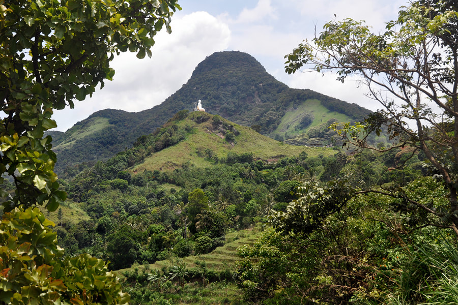
There are to roads from Kandy to Mahiyangana and Batticaloa. The faster one (B492) runs along the southern banks of Victoria Reservoir and Randenigala Reservoir and then crosses the Randenigala dam and the paddy area of Minipe (B474). The shorter one (A26) is the mountain road, which is famous for its serpentine road leaving the highlands to the Bintenna Plains near Mahiyangana. It has scenic views to the Mahaweli Valley and the Knuckles Range. Hunnasgiriya is the village at the highest point of this mountain road. Hunnasgiriya Peak and a new Buddha statue are located close to the village. In Hunnasgiriya, a 29 km long cul de sac branches off to Meemure, which is the best starting point for trekking tours in the Knuckles Range. This even more scenic road runs along Deanston (Mini World’s End) and Corbet’s Gap, which is one of the most spectacular vantage points of the island. Known as Attala-Wettuwa in Sinhala, the British named this mountain pass by after a British surveyor who had mapped this area.
|
Find a list of 270 Sri Lanka travel destinations & attractions: CLICK HERE Our illustrated list of places of interest is sorted by travel regions, more precisely: by 22 most recommendable places for overnight stays. All 270 sights are within day-trip distance from one of those 22 major locations. (Please understand: Loading 270 images requires more seconds than usual.) |
Why travel with Lanka Excursions Holidays?
+ We are a local agency owned and run by Sri Lankans, not part of international holdings
+ We are well known for our direct and personal relationships with travellers
+ We facilitate authentic meetings with locals who are not from the tourism sector
+ We follow a strict policy not to push guests to visit shops and shops and shops
+ We have an unrivalled expertise to show you places off the beaten path
+ We provide genuine information instead of clichés and tourism industry slogans
Our ambition is to provide high-quality information in preparation of your Sri Lanka holidays
... and even more superb travel experiences
... and even more superb travel experiences
we also run our own guesthouse near Anuradhapura:
First House Mihintale
87, Missaka Mawatha, Mihintale 50300, Sri Lanka.
0094 71 6097795
87, Missaka Mawatha, Mihintale 50300, Sri Lanka.
0094 71 6097795
|
Lanka Excursions Holidays
Registration Number SLTDA/SQA/TA/02179
255/24, "Green Park" Dawatagahawatta, Thimbirigaskatuwa, Mahahunupitiya East, Negombo, Sri Lanka
Office: +94 31 223 991 Hotline: +94 71 6097795 [email protected] Lanka Excursions Holidays office hours 8.00 to 6.00 p.m. daily (except from June Fullmoon Day)
|
if not stated otherwise, texts and photos provided by Ernst A. Sundermann, sales manager of Lanka Excursions Holidays
all rights reserved, © 2016 Lanka Excursion Holidays
all rights reserved, © 2016 Lanka Excursion Holidays


