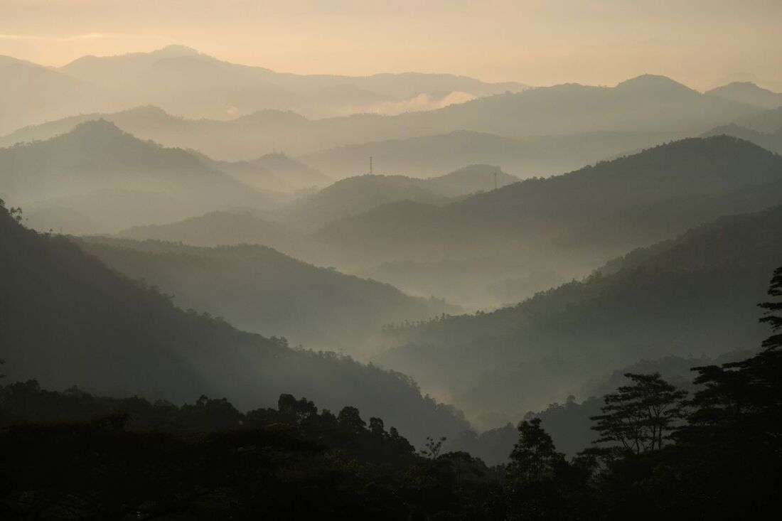
Hanthana Range in the central Highlands of Sri Lanka is the backyard mountain of Kandy, just southwest to the center of the city. The Hanthana Range, declared as an environmental protection area in February 2010, has become an increasingly popular hiking destination, also attracting some foreign holiday makers, though not yet in large numbers.
Geography
The Hanthana Range forms the northernmost part of the main range of Sri Lanka's central highlands, stretching from here 35 km to the south to Pidurutalagala, the island's highest peak, situated near Nuwara Eliya. However, Hanthana Range is separated from the highest part of the main range by a trench, the valley of Galaha, which is just below the peak of Uragala, the southernmost mountain of Hanthana.
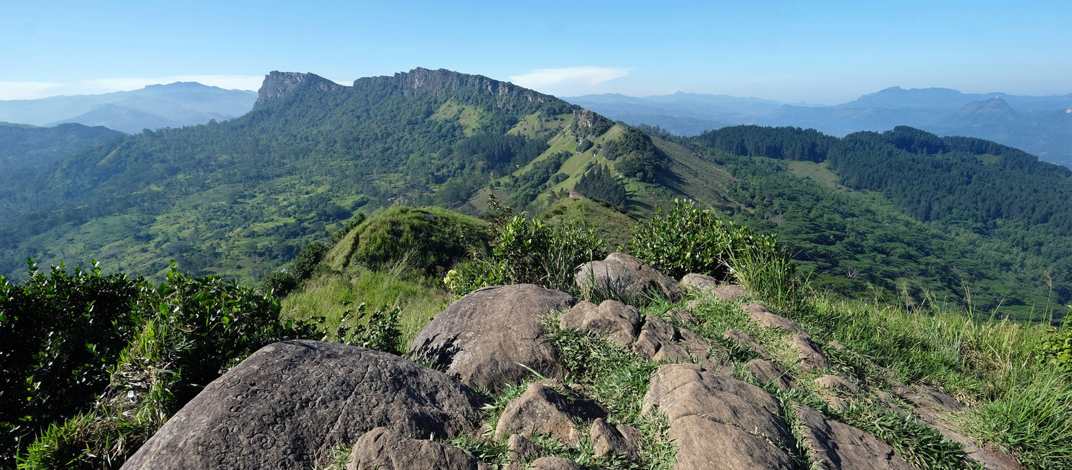
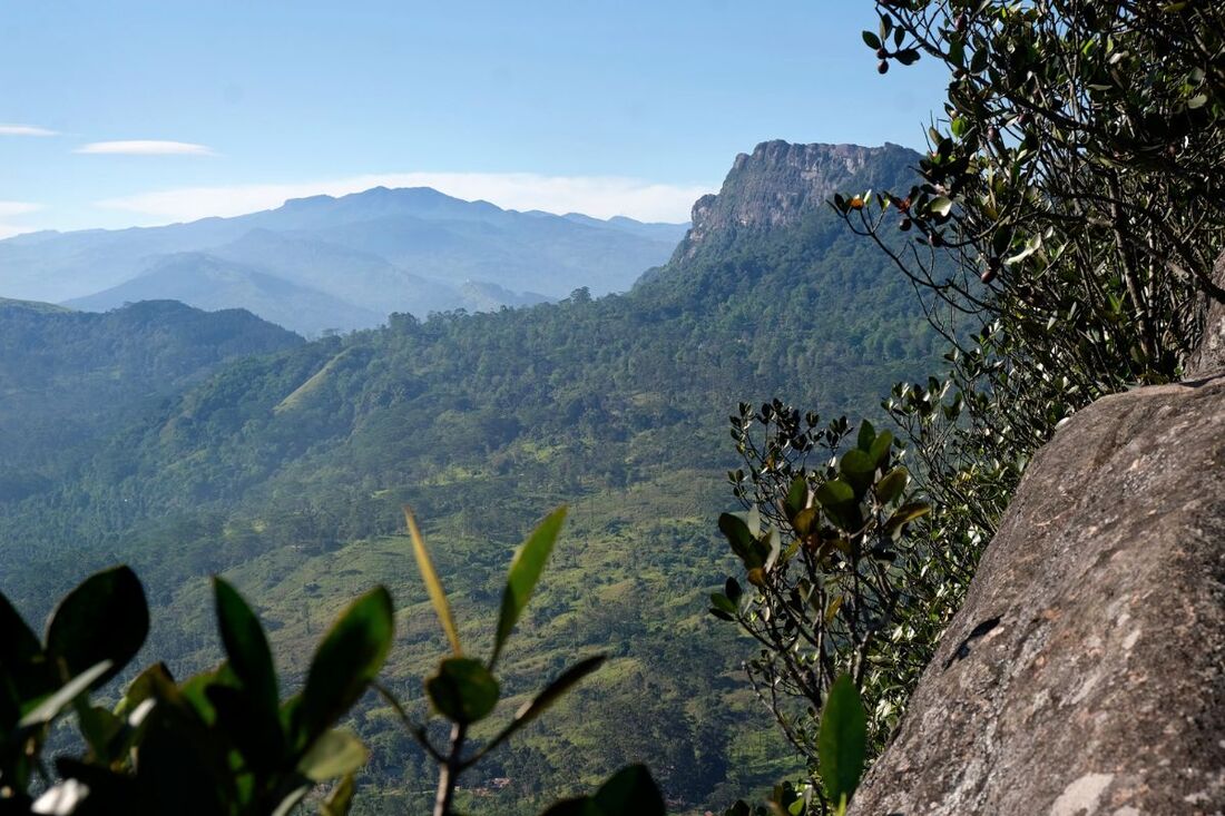
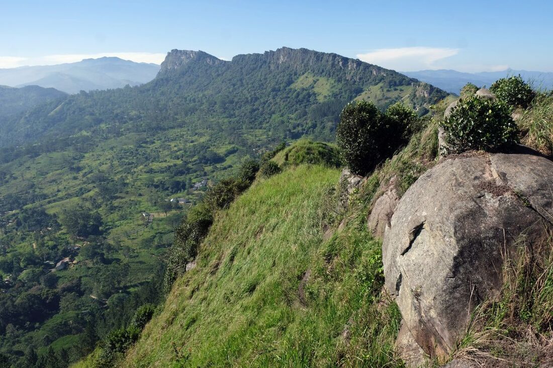
The Hanthana mountain Range has several peaks, the highest ones can not be seen from Kandy, they are at the southwesternend of the range, namely Katusu Konda, about 1300 m (4270 feet) above sea level, and Uragala, which is almost as of the same height, reaching 1260 m (4130 feet). Of these two main peaks, Katusu Konda can be seen from the viewpoints near the abovementioned broadcasting towers. From other directions, both peaks are easily recognizable by their sharp cliffs and the triangular shape of the summits, with almost vertical escarpments to the east and slopes of 100% inclination (45 degrees, or 1:1) on the western flanks. Both spectacular summits can reached without mountaineering skills. However, hiking on their crests is truly walking on knife-edge and a slip would be fatal.
The Hanthana Peak closest to Kandy and Peradeniya is easily recognizable by the two broadcasting towers on the top. The crest of Hanthana Range near the two towers is a favourite destination among Sri Lankan hikers. Particularly on weekends and bank holidays you will meet several small groups of families or friends when walking along the ridge, but there are only few foreign visitors, though Hanthana is not at all unknown to guidebook authors and tour guides and tuctuc drivers and hotel staff in Kandy. Just ask them. For sure, they will recommend the hike for the scenic beauty. The mountain location is often chosen as setting for movies and music videos.
Hiking in Hanthana Mountain Range
The starting point of this Hanthana hike is in only 6 km (4 miles) distance from the center of Kandy by road. More precisely, the trail starts near the mountain pass, the highest point of the road via the Ceylon Tea Museum to Galaha. This pass is at an elevation of 850 m (2790 feet) above sea level, whereas the nearby peak of the broadcasting tower and the crest running from there to the viewpoint called World's End, are at an elevation between 1000 and 1050 m (up to 3450 feet). All in all, the hike from the mountain pass to the Hanthana World's End is 2 km (1.3 miles) long. However, the altitude difference is almost 200 m (more than 600 feet). And nearly half of it has to be overcome (just before reaching the sait two towers) by a steep uphill trail of only 250 m (800 feet) in length. This is to say, due to the steep incline a short passage of the climb is strenuous indeed.
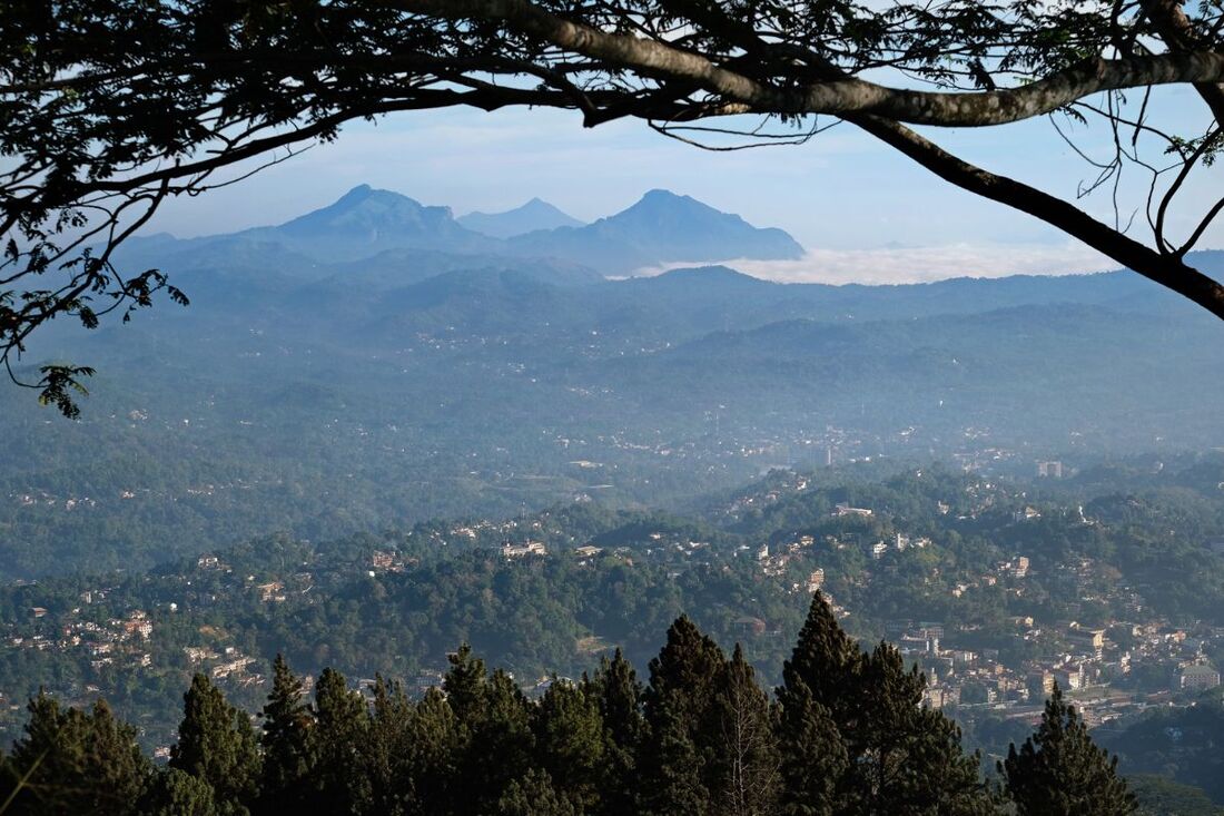
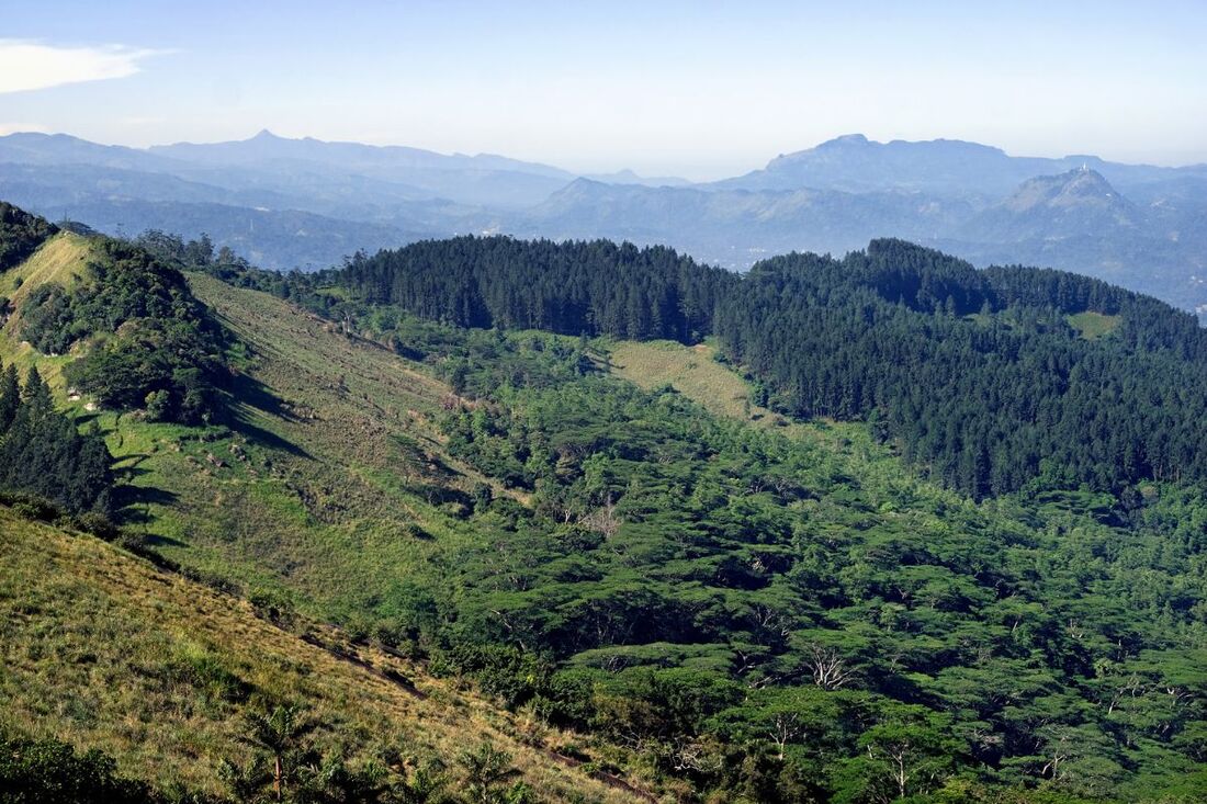
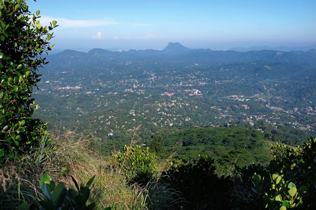
On the top of the ridge, stretching from the broadcasting towers zo the rocks of the so-called Hanthana World's End, there are several vantage points, with views to all directions. The said two cliffs of the montains Katusu Konda and Uragala in the southwestern direction can be seen from many places. The best view to the town of Kandy in the opposite direction is from the said steep part of the access path to the broadcasting towers. From there, the Sandagiri Seya is to the east, the mountains at the horizon belong to Knuckles Range. In particular, the "Five Knuckles" peaks are well recognizable. The conical mountain to the west is Alagalla Peak near Yaggala. The Alagalla Range marks the border to the Kegalla District in Sarabagamuwa Province. Near that border is also the Ambuluwawa mountain behind Gampola, which can be identified by its white tower. Further in the southwest is the Dolosbage Range behind Nawalapitiya, also part of the border to Sabaragamuwa. Very clear weather conditions provided, even the iconic triangle of Adam's Peak (Siri Pada) can be sighted. In the very south, to be seen to the left of Katusu Konda and Uragala is Sri Lanka's highest mountain range between Galaha and Nuara Eliya.
On the top of the ridge, stretching from the broadcasting towers zo the rocks of the so-called Hanthana World's End, there are several vantage points, with views to all directions. The said two cliffs of the montains Katusu Konda and Uragala in the southwestern direction can be seen from many places. The best view to the town of Kandy in the opposite direction is from the said steep part of the access path to the broadcasting towers. From there, the Sandagiri Seya is to the east, the mountains at the horizon belong to Knuckles Range. In particular, the "Five Knuckles" peaks are well recognizable. The conical mountain to the west is Alagalla Peak near Yaggala. The Alagalla Range marks the border to the Kegalla District in Sarabagamuwa Province. Near that border is also the Ambuluwawa mountain behind Gampola, which can be identified by its white tower. Further in the southwest is the Dolosbage Range behind Nawalapitiya, also part of the border to Sabaragamuwa. Very clear weather conditions provided, even the iconic triangle of Adam's Peak (Siri Pada) can be sighted. In the very south, to be seen to the left of Katusu Konda and Uragala is Sri Lanka's highest mountain range between Galaha and Nuara Eliya.
Sandagiri Seya & Ceylon Tea Museum & International Bird Park
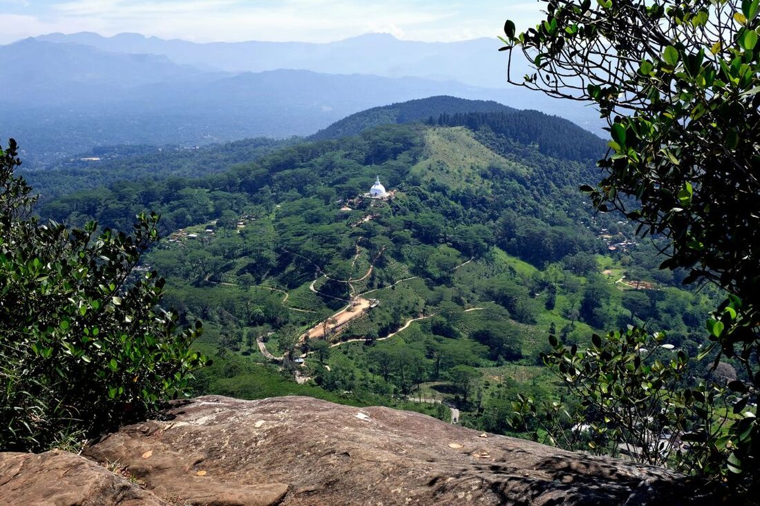
Apart from the panoramic viewpoints on the crest, there are three more major attractions close to the said mountain pass of the Hanthana road. Just at the opposite side of the pass (when seen from the hiking peak) is a newly erected white dagaba of Sandagiri Seya with a huge hall inside. This is the largest stupa in and around Kandy, also a good and much easier to reach viewpoint.
The Ceylon Tea Museum in a former tea factory in only 1.6 km (1 mile) distance from the said Hanthan mountain pass, where the hiking trail and the access road to the Sanadagiri stupa start. The tea museum can be seen to the right when driving down to Kandy. A big signboard is posted at the junction with the small access road.
A new attraction, particularly interesting for families with children, is the Hanthana International Bird Park only 300 m (1000 feet) behind the tea museum. The park was declared open to the public by President Ranil Wickremesinghe in February 2023. The Bird Park of Hanthana covers an area of about 4 acres and is home to over 100 species of birds, including some rare species and also some species several endemic to the island, for example Sri Lanka Spurfowl, Sri Lanka Junglefowl, and Yellow-fronted Barbet. The term "international" in the name of the bird park indicates the conceot of showing birds from other parts of the world, too.
