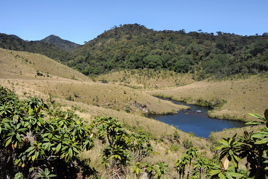
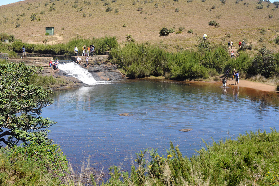
Horton Plains, Sri Lanka’s only national park declared a World Heritage Site, is an eerie highland plateau popular with hikers. A circular trail of 10 km length winds through cloud forests and open grasslands. Major attractions are scenic spots such as Baker's Falls and the two spectacular panoramic viewpoints called “Big World’s End” and “Litte World’s End”. Horton Plains, situated at an elevation of more than 2000 meters above sea level, is Sri Lanka’s only national park within the hill country and the only one where hiking is permitted without ranger, though strict rules have to be observed within the national park boundaries.
|
It’s highly recommendable to start the walk in the early morning. Before 10.00 a.m. chances are higher that clouds will part at the World’s End vantage points. Therefore, you should leave Nuwara Eliya or Haputale before dawn and you should walk the circular road clockwise, first visiting World’s End and Baker’s Falls afterwards, on the way back.
|
Content of our Horton Plains page: Geography - Access - Hiking - Deer - Grasslands - Cloud Forest - Little World's End - Big World's End Baker's Falls - Ponds History |
Average temperature varies between 10 and 15 degrees, the mean maximum daily temperature in this area is 16 degrees centigrade. In the noon and afternoon, the plains are misty. In fact, you are in the clouds and Horton Plains is part of Sri Lanka’s cloud forest area. Ground frost occurs frequently in February.
So be prepared. It’s highly recommendable to carry a raincoat or a jumper and umbrella with you. You definitely need strong and comfortable walking shoes, the trail is quite muddy in places and stony in others. Sunglasses and a cap to warm your ears and to protect your head against alpine sun’s UV radiation make sense, too.
On weekends and public holidays, particularly during weekends prolonged by Poya Days, Horton Plains will get crowded. But most vistors are Sri Lankans, not foreign tourists. Although you will then not be able to enjoy the silence of this mystic place, you can make new contacts with Sinhalese and Tamil hikers.
Horton Plains Geography
|
Horton Plains was declared a national park in 1988. The plains, situated on a mountainous massif second in height only to the central massif of Nuwara Eliya, s situated in the southermost range of Sri Lanka’s highlands. It is positioned at the eastern boundaries of this range, which is Sri Lanka’s largest area of Upper Montane Forest Range. The western boundary of the ridge is marked by Siri Pada (Adam’s Peak) in 35 km distance.
|
Horton Plains National Park covers an area of 32 square kilometers. The tableland is situated at an altitude between 2000 and 2100 m above sea level, but some park borders are as low as 1200 m. The highest peaks are Kirigalpotta, Thotupola and Kudahagala, all of them higher than Siri Pada. With 2,388 above mean sea level, Kirigalotta in the west of Hoton Plains National Park is the second tallest montain in Sri Lanka and the island’s highest point accessible to the general public, since Sri Lanka’s highest peak at all, Pidurutalagala (2.534 m) near Nuwara Eliya, is occupied by a military base, access prohibited. Thotupola Kanda, near the northernmost point of the park area, is the third highest mountain in Sri Lanka, reaching 2,357 m above sea level. Sri Lanka’s fourth tallest mountain too is situated within the national park borders. The 2,320 m high Kudahagala, also known as Agra Bopath, is located only 2 km to the northeast of Kirgalpotta.
In some years, Horton Plains can record over 5000 mm of rainfall. In Sri Lanka, this amount of precipitation is only second to Sinharaja Rain Forest (6000 mm). For comparison: annual rainfall in the tea highlands is about 2500mm on average. Nonethelss, the humidity is relatively low at 65%. During the dry season, the temperature can drop to 5 degree centigrade in the day time. The mean annual temperature is 13 °C, but the temperature varies considerably and can reach up to 27 °C.
Apart from the central highlands around Nuwara Eliya, Horton Plains is also one of the most important catchment areas in Sri Lanka, feeding the Mahaweli, the largest river of the island. Horton Plains are also the headwaters of the Walawe Ganga, the most important river of the south. Horton Plains and the adjacent Peak Wilderness are part of the principal watershed of Sri Lanka.
Travel to Horton Plains
|
The most common approach is by road from the north via Pattipola or from the east via Ohiya. Most visitors arrive from Nuwara Eliya, which is 30 km to the north of Horton Plains’ Visitors Centre. The main entrance to Horton Plains National Park is located on the Pattipola road from Nuwara Eliya. A second gate is at the Ohiya Road from Haputale, which is 33 km to the east.
No public transport is available along the road which runs through the National Park. But particularly for guests enjoying our Lanka Excursions Holidays transport services, it’s possible to visit Horton Plains on the way from Nuwara Eliya to Haputale (or to Bandarawela or Ella). This makes sense in case you want to enjoy the hike to World’s End and Baker’s Falls. Just crossing Horton Plains by car without any halt does not prevent you from paying the National Park entry fee. Be aware, that long cews of cars and correspondingly long waiting times can occur at the Pattipola entrance of the National Park during the main season (Christmas and Easter holidays in particular). |
Please pay attention: Horton Plains is a strict “no plastic” and “no open flames” zone. Some Sambar deer have died after eating polythene litter, because it blocked their food passages. Visitors are not permitted to carry any polyethylene bags or match boxes or cigarette lighters. And this is not just a rule mentioned on signboards. It will be checked indeed. At the gate to the circular trail, close to the car park, you must be willing to open your luggage and show the contents to a park rangers. However, you may pack your snacks in airtight boxes. Camp fires are strictly prohibited inside the national park. Visitors are also requested to stay in the trails, not to pick flowers and not to throw stones into the ponds and streams. Don’t misunderstand. Strict regulations are not an expression of a bully mentality, which usually is alien to Sri Lankans. Consider it to be a proof for high standards of environmental awareness, which is outstanding in Sri Lanka when compared to other developing countries. |
A third road to Horton Plain arrives from the southern lowlands, starting at Weli Oya Bridge at the Colombo-Batticaloa Highway (A4) and passing Bambarakanda Falls and also entering the park at the Ohiya Gate ticket office. However, this steep winding road is not sealed, it’s only passable for vehicles with four-wheel drives and the climb is highly dangerous after rainfall when the slopes are slippy. This rarely used access road to Horton Plains is called “Devil’s Staircase”.
Public Transport from towns in the highlands is only available up to Pattipola and Ohiya. Ohiya Railway station is in 11 km distance from Horton Plains’ visitors centre, where the scenic hiking trail starts. This very center of Horton Plains is also known as “Farr Inn”. Pattipola, Sri Lanka’s highest railway station, is in 10 km distance from the car park.
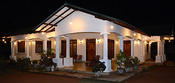
There is no accommodation at the plains except from two lodges and three camping sites which must be book beforehand.
Hiking on Horton Plains
Both the main trail called “World’s End and Bakers Falls Trail” and the Kirigalpotta trail to the highest summit start at the Horton Plains Information Center, which provides interesting information and also publications relevant to Horton Plains. It’s also known as Farr Inn, named after Thomas Farr, the first Western explorer of Horton Plains, who was a famous hunter in 19th century British Ceylon. The circular hike to World’s End and Baker’s Fall is by far the most popular. It’s easy to find and suitable for unexperienced hikers and even for children, although partly not comfortable. However, there are other hiking trails on Horton Plains, too, namely to the summits of Sri Lanka’s second and third highest mountains, Kirigalpotta and Thotupola respectively.
Kirigalpotta is located 5 km to the west of Red Bridge, as the crow flies, or within 7 km walking distance, wheras Thotupola is 4 km to the north of the visitor’s centre and only 1 km east of the national park’s Pattipola gate, as the crow flies. Only a few metres away from the Pattipola entrance starts a two kilometers long trail to the top of the mountain. The Sinhala name “Thotupola” means “landing market place”. This toponym is the reasson why the mountain is related to a legend of Rama and Ravana. According to the Indian Ramayana Epic, Ravana kidnapped Rama’s wife Sita and escaped to Sri Lanka in a flying chariot called Pushpaka Vimana. Thotupola is believed to be one of its prehistoric airports, so to speek.
Both summits, Kirigalpotta and Thotupola, surmount the plains by only a few hundred metres and do not provide amazing views and the pathes are not easy to find. The better vista is that of Kirigalpotta. However, for first-time visitors, the circular trail to World’s End is much, much more recommendable, as mentioned abive. A trekking trail of approximately 20 km leads downhill to Belihul Oya on the Colombo–Badulla highway (A4). It’s recommendable for trekkers, who can arrange a pick-up service in Belihul Oya.
Chances to avoid rainfall and to enjoy the spectacular views from World’s End are higher in the main season between Christmas and Easter. From December to February, temperatures can be fairly low on Horton Plains, but these are the clearest months. The spring season from March to May is also recommendable, it’s less cold and flowers bloom all over the plains. From June to September, the monsoon winds are strong and clouds and mist are more frequent. Nevertless, Horton Plains is not as rainy during the summer monsoon as you might think, because the Sinharaja Range in front is a kind of shield receiving most of the rainfall. Tough mist can persist in the most of the day during the wet season, August is in fact not a bad month to visit the mystic Horton Plains, where the autumn months are those with highest precipitation.
Sambar deer on Horton Plains
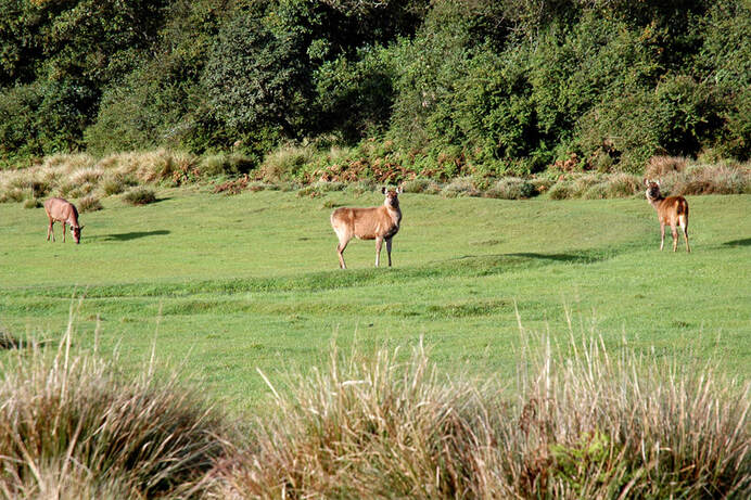
Horton Plains is that place in the entire world where visitors have best chances to observe herds of wild Sambars. The Sambar (Rusa unicolor) is the largest deer on the Indian subcontinent. Up to 246 cm long and up to 160 cm high and with a weight typically between 200 to 320 kg, it's one of largest extant deer species at all, second only to elks (moose, Alces alces) and larger than Europe's and nortwestern Africa's Red Deer (Cervus elaphus). Sambar also occurs in Southeast Asia and southern China and Taiwan, the Indian and Sri Lankan Sambar subspecies (Rusa unicolor unicolor) is the largest.
Adult males and pregnant or lactating females possess a red glandular spot below their throats. Although the species is listed as vulnerable on the IUCN Red List, it occurs in abundance on Horton Plains. Males live alone for much of the year and females live in herds much smaller than other deer species. Herds on Horton Plains are larger than usual.
Sambars are the favourite prey of tigers and crocodiles. They have almost no natural enemies on Horton Plains, since leopards usually prey only on young or sick Sambars, though they are able to attack healthy adults, too. However, the leopard population on Horton Plains has increased due to the sheer explosion in Sambar deer in recent decades. The number of Sambars in the national park might well be 2000. The numbers are too high for the montane forest ecosystem, as Sambars strip barks of the trees and feed on saplings. Dieback of trees is a serious problem in Horton Plains National Park. Although there are multiple causes for the dieback phenomenon, the huge Sambar population undoubtedly amplifies the effects. A side effect is the decrease of the population of endemic Purple-faced Leaf Monkeys heavily dependent on the trees. Sambar have benefited from an introduced grass species (Pennisetum), but threaten the coarse native grass (Cymbopogon).
As Sambars are nocturnals or crepusculars, they can be spotted in the early morning and in the evening. Sambar deer is the most common animal in the plains.
Patana Grasslands of Horton Plains
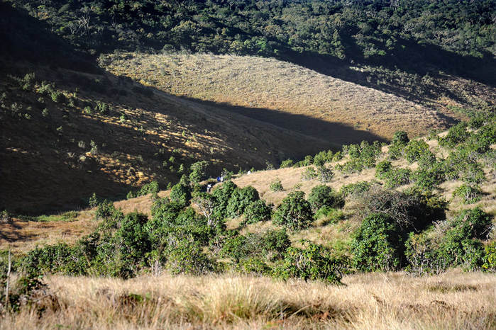
Apart from the scenic panoramas of World’s End and the foaming waters of Bakers Falls, the main attraction of the Horton Plains National Park is the diversity of beautiful landscapes it posses, undulating grasslands with clean streams and surrounded by dense montane forest. The Sinhala name of Horton Plains is Maha Eliya Thenna. This translates to “Great Clearing Plain” and refers to the open grasslands. The Sinhala name for grasslands in the hillcountry is “Patana”. The wet Patana form one of the two distictive groups of vegetation in Horton Plains National Park, the other one being the subtropical montane evergreen forests. One of the most distinctive species particularly in the intermediate zone is Rhododendron arboreum, known as "Ashoka" of "Maha Rathmal" in Sinhala. It flowers from April to July and then covers the Horton Plains with a red coat. It is pollinated by birds, particulalry by the endemic Sri Lanka Withe-eye (Zosterops ceylonensis).
Passing over the Red Bridge near the car park, visitors first cross a grassland area and comes upto a Y-junction, where the looped trail starts and ends. Going along the trail towards the left leads to Little World’s End, whereas turning to the right and walking the trail counter-clockwise leads to Chimney Pool and Baker’s Falls first. Proceeding clockwise is more recommandable, as already mentioned, because the earlier you arrive at World’s End, the better are your vistas from there.
Passing over the Red Bridge near the car park, visitors first cross a grassland area and comes upto a Y-junction, where the looped trail starts and ends. Going along the trail towards the left leads to Little World’s End, whereas turning to the right and walking the trail counter-clockwise leads to Chimney Pool and Baker’s Falls first. Proceeding clockwise is more recommandable, as already mentioned, because the earlier you arrive at World’s End, the better are your vistas from there.
Montane Cloud Forest of Sri Lanka's Central Highlands
Horton Plains National Park is part of the World Heritage Sita called the “Central Highlands of Sri Lanka”. The two other parts are the adjacent Peak Wilderness, stretching from Horton Plains to Siri Pada (Adam’s Peak), and Knuckles range at the opposite side of the hillcountry, northeast to Kandy. These are the untouched areas of Sri Lanka’s highlands, whereas most of the hillcountry consists of tea monoculture. Sri Lanka’s and South India’s mountains in their natural state are a unique ecosystem with abundant flora and fauna considered one of the planet’s “a super biodiversity hotspot”. The ecosystem of the protected area is mostly covered by evergreen montane cloud forest. It’s unlike any other vegetation zone in the island. Many species found on Horton Plains, particularly woody plants, are endemic to the region.
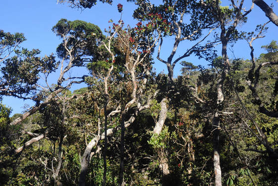
As mentioned above, the trail opens up with an expansive view of bare Patanas. Once these grasslands are passed, the trail leads for about 2 km through a densely wooded cloud forest. Nellu shrubs and Keena trees are predominent. Spices such as cardamom and cinnamon grow in this wilderness. It's very dark inside the montane cloud forests. Accordingly, plants have to compete hard to obtain enough sunlight. This is why many of the trees on Horton Plains are covered with lianas and vines, wild pepper being a prominent of those secondary plants. Some plants however grow entirely on trees, rather than in the grounds. Such plants are called "epiphytes". For example, many orchids are such "air plants". Growing high above the ground of course results in a disatvantage, namely lack of water. Epiphytes are able to collect water from the mist. Even more, they are organisms that not only derive not their moisture from the air, but also collect their nutrients from high above the ground, just from the debris accumulating around it. By the way, epiphytes differ from parasites in that epiphytes grow on other plants for physical support and do not necessarily negatively affect the host.
Little World's End
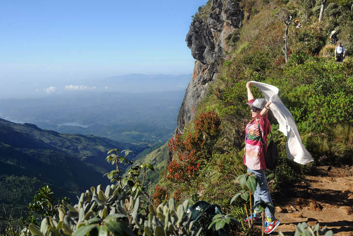
In about 2 km distance from the entry point at Red Bridge is Little World’s End. Actually, there are two World’s Ends at Horton Plains. Both escarpments along the circular trail are situated at southwestern edge of the Horton Plains at an altitude of 2140 m. The smaller escarpment called “Little World’s End” drops 274 m vertically. Sri Lankans tell that people threw themselves from the cliff out of lovesickness. Actually, several people died at World’s End due to the lack of railings and warning signs. In August 2014, a Polish couple plummeted to their deaths when trying to take selfies with their two children. The first person to survive a fall from Little World’s End was a Dutch honeymooner who had taken a few steps back to take pictures of his new bride. Flewing off the unprotected cliff, he was lucky to fall on a tree about 130 feet from the top and could be rescued from there by soldiers of the Sri Lankan army. That incident happened in February 2015.
Big World's End
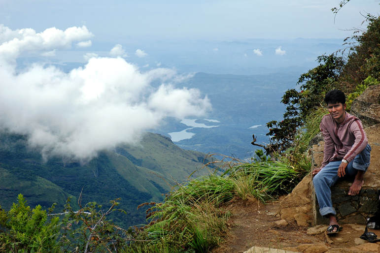
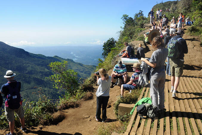
It takes another 30 minutes to reach the Big World's End from the Little World's End using the forest path. If you are not suffering from vertigo and if you promise not to try any funny jokes, there is an alternative path running just along the escarpment. It offers incredible views to the lowlands and also to the cliff of Big World’s End. The latter is very similar to Little World’s End, but here the drop is 880 meters almost vertically. The bottom of the valley is in fact 1,500 metres below the Big World’s End vantage point.
As already mentioned, the panoramic views tend to be obscured by the mist from around 10 am onwards. Thus, you should start your hike at the car park about 7.00 a.m. to be sure to reach Big World’s End at about 9.00 a.m, before the clouds roll in. Almost every day, a huge blanket of mist then starts folding over the vista before noon and soon covers the entire plains for the rest of the day. However, the dynamic whether, the sudden alternation of blue skye and misty clouds makes the hike on Horton Plains even more exciting.
As already mentioned, the panoramic views tend to be obscured by the mist from around 10 am onwards. Thus, you should start your hike at the car park about 7.00 a.m. to be sure to reach Big World’s End at about 9.00 a.m, before the clouds roll in. Almost every day, a huge blanket of mist then starts folding over the vista before noon and soon covers the entire plains for the rest of the day. However, the dynamic whether, the sudden alternation of blue skye and misty clouds makes the hike on Horton Plains even more exciting.
Baker's Falls in Sri Lanka
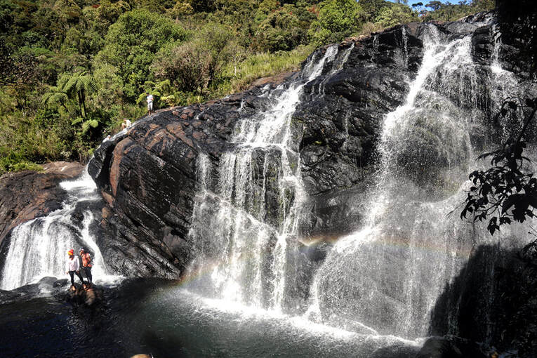
Just behind Big World’s End, the trail turns to the right and leads back to grassland areas. Alternatively, taking the anticlockwise path would first bring you to Bakers Fall after 3 km from the trail head at Red Bridge (which is close to the car park and Visitors Center and checkpoint, see above). In order to see the waterfalls, you need to move off the main track and climb down a rocky path for about 300 meters. Then your reach two viewing platform of the waterfalls. Baker’s Falls are named after no less than Samuel Baker, the later explorer of the River Nile. Baker, who was the pioneer settling in Nuwara Eliya in the mid 19th century used to visit Horton Plains for hunting expeditions.
The waterfall formed by the upper reached of Belihul Oya, which is a tributary of the Walawe River. The picturesque waterfall is 20 metres high.The moisture from Baker's Falls plays a crucial role in the local plant and animal communities. On the banks, a profusion of mosses and algae grow in the misty spray. The endemic pygmy lizard (Cophotis ceylanica) dwells in the moist tree ferns near the falls. Baker’s Falls also is a natural point of separation of the aquatic fauna of the Belihula Oya stream, with different species adapted for life upstream and below.
The waterfall formed by the upper reached of Belihul Oya, which is a tributary of the Walawe River. The picturesque waterfall is 20 metres high.The moisture from Baker's Falls plays a crucial role in the local plant and animal communities. On the banks, a profusion of mosses and algae grow in the misty spray. The endemic pygmy lizard (Cophotis ceylanica) dwells in the moist tree ferns near the falls. Baker’s Falls also is a natural point of separation of the aquatic fauna of the Belihula Oya stream, with different species adapted for life upstream and below.
Ponds at the upper Belihul Oya stream
Behind Baker’s Falls, the track runs through open patina grassland again. Between the waterfalls and the trail head at Red Bridge, there are three ponds. They are called Governor’s Pool, Leg of Mutton Pool and Chimney Pool. The Governor’s Pool can not be visited, as it is too far from the circular trail and leaving the track is not permitted in Horton Plains National Park. The Chimney Pool has a man-made bund.
The pool is in abundance with Kekatiya plants (Aponogeton jacobsenii) which also can be seen in the stream running along the trail. Dwarf Bamboo (Arundinaria densifolia), known as "Kuru Una" in Sinhala, also grows in the marshy bottom lands next to the streams and ponds. The young leafs of Sri Lanka’s smalled bamboo provide a favourite forage for Sambar deer.
Rainbow trouts were introduced by the British for the purpose of angling. They affect the stream ecology in a negative way, as they prefer to eat the shrimp species Caridina singhalensis, which, as suggested by the scientific name, is endemic to Sri Lanka. The shrimp population in the Horton Plains streams has been significantly reduced by the trouts.
History of Horton Plains
Stone tools dating back to prehistoric Balangoda culture have been found on Horton Plains. What’s even more interesting: Rasicarbon research of pollen revealed that humans inhabiting Horton Plains in that period started domesticating barley and oat as crops as as early as 14,000 years ago, at least three millenia prior to the “neothilic revolution” in the Middle East and China. Besides cereal grain pollen, the research found evidence of forest clearing and grazing. As amazing as this discovery are indeed, there is no reason for exaggerations such as dating back the begin of the neolithic age or crediting Sri Lanka’s Balangoda culture with the neolthic revolution, because such early agrarian experiments are known from various parts of the world without having revolutionary consequences for human societies. They did not mark the beginning of a sustained evolution culminating in urban societies. Rather, the introduced crop cultivation appears to have been a subsidiary source of food for a hunter-gatherer society and the agrarian techniques fell into oblivion several generations later on. From 6500 years ago the evidence shows a decline in human activity on Horton Plains and 3000 years ago the area was abandoned.
The remote grassland plains in the south of Sri Lanka’s highlands were rediscovered by the British planter Thomas Farr around 1820. In 1834, the open tableland formerly known as Maha Eliya was named Horton Plains in honor of Anne Beatrix Horton, heir of the Catton Hall estate in Derbyshire. In 1806, she married Robert Wilmot, who on the death of his father-in-law added “Horton” as a second surname. Afterwards, Sir Robert Wilmot-Horton became Governor of Ceylon in 1831 and ruled until 1837. Starting with Sir Samuel Baker, who introduced potato and vegetable cultivation in Nuwara Eliya, Horton Plains served as a hunting ground for those genuine gentlemen of British origin who enjoyed killing animals as an integral part of a higher lifestyle. In the 19th century, Horton Plains was rich with elephants, but the entire population was hunted down to extinction by the colonialists. However, environmental awareness was not entirely alien to the British. Sir Joseph Dalton Hooker advised the British Government to leave all montane forests above 5000 feet undisturbed. An Administration Order issued in 1873 prevented clearing and felling of forests in this region. Nevertheless, Horton Plains continued to be a Sambar deer hunting ground till the end of the colonial period. After independence, Horton Plains was designated as a wildlife sanctuary in 1969 and elevated to the status of a national park in 1988. Horton Plains and neighbouring Peak Wilderness contain the most extensive area of cloud forest surviving on the island. In 2010 both areas together with Knuckles Forest Reserve were inscribed on the World Heritage List.
